Vacqueyras Vaqueiras | |
|---|---|
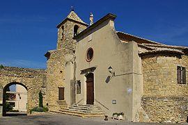
 The church of Vacqueyras | |
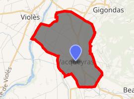
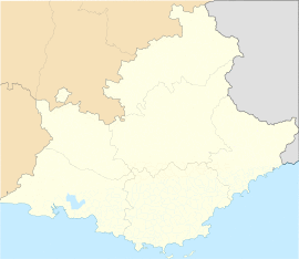
Location of Vacqueyras  | |
| Coordinates: 44°08′17″N 4°58′59″E / 44.138°N 4.9831°E | |
| Country | France |
| Region | Provence-Alpes-Côte d'Azur |
| Department | Vaucluse |
| Arrondissement | Carpentras |
| Canton | Vaison-la-Romaine |
| Intercommunality | CA Ventoux-Comtat Venaissin |
| Government | |
| • Mayor (2020–2026) | Philippe Bouteiller[1] |
| Area 1 | 8.97 km2 (3.46 sq mi) |
| Population (Jan. 2017)[2] | 1,308 |
| • Density | 150/km2 (380/sq mi) |
| Time zone | UTC+01:00 (CET) |
| • Summer (DST) | UTC+02:00 (CEST) |
| INSEE/Postal code | 84136 /84190 |
| Elevation | 68–254 m (223–833 ft) (avg. 147 m or 482 ft) |
| 1 French Land Register data, which excludes lakes, ponds, glaciers > 1 km2 (0.386 sq mi or 247 acres) and river estuaries. | |
Vacqueyras (Occitan: Vacairaç) is a commune in the Vaucluse department in the Provence-Alpes-Côte d'Azur region in southeastern France.
Vacqueyras is also the name of an Appellation for a wine from the Côtes du Rhône.
Geography
Access
Departmental Route 8 arrives at the north of the commune, then Departmental Route 7 traverses the commune on a north-south axis, forking to the southeast near Beaumes-de-Venise. Departmental route 52 then continues on to the south.
Departmental Route 233 leaves at the east near Peyre's Wood.
Neighbouring communes
Terrain
Containing many alternating little valleys of minimal depth and plains + hills to the east, (261 m to the Muse), the extremity is at the Dentelles de Montmirail.
Geology
The Dentelles de Montmirail are the furthest west of the Massif des Baronnies and constitute the first advance of the Alps into the Rhone Valley.
Rocky stones from the Late Jurassic (Tithonian) period with clay-limestone soil dominate the area.
Hydrography
The small stream Limade[3] passes to the north of and flows into the Ouvèze, which passes to the west.
The Canal de Carpentras crosses the commune, built in 1856, and irrigates the commune, graced by a network of fillioles.
Plants
Mediterranean plants on the Dentelles de Montmirail compare to those from the Alpilles in many places. One can rediscover there aromatic plants (thyme, rosemary, fennel, lavander), Evergreen Oaks and Provençal White Pines (Aleppo Pines), etc.
Vines grow well on the coasts but also in the stony plains, in high terraces.
Population
| Year | Pop. | ±% |
|---|---|---|
| 2005 | 1,019 | — |
| 2006 | 1,048 | +2.8% |
| 2007 | 1,060 | +1.1% |
| 2008 | 1,056 | −0.4% |
| 2009 | 1,053 | −0.3% |
| 2010 | 1,050 | −0.3% |
| 2011 | 1,076 | +2.5% |
| 2012 | 1,085 | +0.8% |
| 2013 | 1,144 | +5.4% |
| 2014 | 1,202 | +5.1% |
| 2015 | 1,260 | +4.8% |
| 2016 | 1,292 | +2.5% |
See also
References
- ^ "Répertoire national des élus: les maires". data.gouv.fr, Plateforme ouverte des données publiques françaises (in French). 2 December 2020. Retrieved 7 December 2020.
- ^ "Populations légales 2017". INSEE. Retrieved 6 January 2020.
- ^ Sandre. "Fiche cours d'eau - Ruisseau de la Limade (V6050700)".
.svg.gif)


