Lafare | |
|---|---|
) A view of the village of Lafare | |
.svg.gif')) Coat of arms | |
Location of Lafare 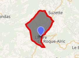 | |
) Lafare ) Lafare | |
| Coordinates: 44°08′52″N 5°03′08″E / 44.1478°N 5.0522°E | |
| Country | France |
| Region | Provence-Alpes-Côte d'Azur |
| Department | Vaucluse |
| Arrondissement | Carpentras |
| Canton | Vaison-la-Romaine |
| Intercommunality | Ventoux-Comtat Venaissin |
| Area 1 | 4.54 km2 (1.75 sq mi) |
| Population (Jan. 2017)[1] | 116 |
| • Density | 26/km2 (66/sq mi) |
| Time zone | UTC+01:00 (CET) |
| • Summer (DST) | UTC+02:00 (CEST) |
| INSEE/Postal code | 84059 /84190 |
| Elevation | 129–528 m (423–1,732 ft) (avg. 150 m or 490 ft) |
| 1 French Land Register data, which excludes lakes, ponds, glaciers > 1 km2 (0.386 sq mi or 247 acres) and river estuaries. | |
Lafare is a commune in the Vaucluse department in the Provence-Alpes-Côte d'Azur region in southeastern France.
See also
References
- ^ "Populations légales 2017". INSEE. Retrieved 6 January 2020.