| ||||
|---|---|---|---|---|
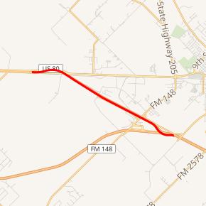 Spur 557 highlighted in red | ||||
| Route information | ||||
| Length | 4.369 mi[1] (7.031 km) | |||
| Existed | 1987–present | |||
| Major junctions | ||||
| West end | ||||
| East end | ||||
| Highway system | ||||
| ||||
)
Spur 557 is a 4.369-mile-long (7.031 km) spur route in the city of Terrell in the U.S. state of Texas. Spur 557 is a freeway connector between Interstate 20 (I-20) and U.S. Highway 80 (US 80). It is signed as "To I-20" eastbound or "To US 80" westbound. Spur 557 is the original routing of I-20 prior to I-20 being rerouted to the south.
The route traverses a largely undeveloped area in Kaufman County, Texas between Forney, Texas and Terrell, Texas and serves to distribute eastbound traffic onto Interstate 20 and westbound traffic onto the U.S. Highway 80 freeway leading into the Dallas-Fort Worth Metroplex.
History
Spur 557 was designated on August 18, 1987 on an old alignment of I-20 when it was rerouted southeast of Dallas.[1] I-20 was originally designated over the route in 1959.[2]
Route description
Spur 557 is a short freeway connector between I-20 and US 80 west of Terrell. It begins at the eastern end of the freeway segment of US 80 and heads towards the southeast. US 80 continues to the east as a surface road to Terrell. Spur 557 has two interchanges between its two termini: one at the Las Lomas Parkway and another at FM 148. The spur merges with eastbound traffic at its eastern terminus at I-20.[3]
Exit list
The entire route is in Kaufman County.
| Location | mi[3] | km | Destinations | Notes | |
|---|---|---|---|---|---|
| | 0.0 | 0.0 | Westbound exit and eastbound entrance, western terminus | ||
| Terrell | 0.9 | 1.4 | Frontage Road | Westbound exit and eastbound entrance | |
| 1.7 | 2.7 | Las Lomas Parkway | |||
| 2.1 | 3.4 | Frontage Road | Eastbound exit and entrance | ||
| 3.0 | 4.8 | ||||
| 4.369 | 7.031 | Eastbound exit and westbound entrance, eastern terminus, I-20 exit 499A | |||
| 1.000 mi = 1.609 km; 1.000 km = 0.621 mi | |||||
References
- ^ a b Transportation Planning and Programming Division (n.d.). "State Highway Spur No. 557". Highway Designation Files. Texas Department of Transportation. Retrieved 2008-03-04.
- ^ Transportation Planning and Programming Division (n.d.). "Interstate Highway No. 20". Highway Designation Files. Texas Department of Transportation. Retrieved 2008-03-05.
- ^ a b Google (2008-03-04). "overview map of Spur 557" (Map). Google Maps. Google. Retrieved 2008-03-04.