| ||||
|---|---|---|---|---|
 | ||||
| Route information | ||||
| Length | 6.256 mi[1] (10.068 km) | |||
| Existed | July 29, 1941[1]–present | |||
| Major junctions | ||||
| West end | Courtney | |||
| East end | ||||
| Highway system | ||||
| ||||
)
Farm to Market Road 2 (FM 2) is a farm to market road in rural southeastern Grimes County, in the southeastern part of the U.S. state of Texas. FM 2 was designated on July 29, 1941.[1]
Route description
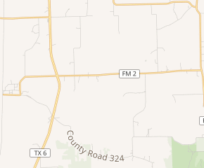
FM 2 begins in the village of Courtney, at Grimes County Road 237 about 1.5 miles (2.4 km) east of the Washington County line (Brazos River). It travels along the northeastern edge of the Texas Department of Criminal Justice's O.L. Luther Unit. It then continues through rural farmland in Grimes County. It then travels east, crossing Texas State Highway 6 (SH 6) and passing several prison farms before ending at FM 362.[1][2]
History
FM 2 was designated in 1941 from Courtney east to SH 6. The designation was extended to FM 362 on May 2, 1962, which added approximately 4.4 miles (7.1 km) to the highway.[1]
As of 2017, TxDOT plans to convert the at-grade intersection with SH 6, regarded as dangerous,[3] into a diamond interchange.[4]
Junction list
The entire route is in Grimes County.
| Location | mi[5] | km | Destinations | Notes | |
|---|---|---|---|---|---|
| | 0.0 | 0.0 | County Road 237 | ||
| | 2.0 | 3.2 | |||
| | 6.3 | 10.1 | |||
| 1.000 mi = 1.609 km; 1.000 km = 0.621 mi | |||||
See also
- List of Farm to Market Roads in Texas (1–99)
References
- ^ a b c d e Transportation Planning and Programming Division (n.d.). "Farm to Market Road No. 2". Highway Designation Files. Texas Department of Transportation. Retrieved 2010-10-03.
- ^ Transportation Planning and Programming Division (2018). Texas County Mapbook (PDF) (Map) (2018 ed.). 1:72,224. Texas Department of Transportation. p. 1598. Retrieved 2020-08-19.
- ^ Surette, Rusty (2016-10-31). "Driver killed while crossing foggy intersection south of Navasota". KBTX-TV.
- ^ "SH 6 and FM 2 Intersection - Grimes County". Texas Department of Transportation. 2017-02-09.
- ^ "Map of FM 2". Google Maps. Retrieved August 1, 2016.