Ylivieska, Finland | |
|---|---|
Town | |
| Ylivieskan kaupunki Ylivieska stad | |
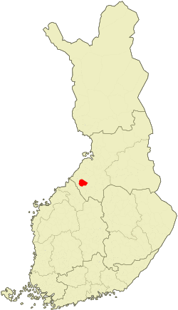
 Location of Ylivieska in Finland | |
| Coordinates: 64°04.5′N 024°32′E / 64.0750°N 24.533°E | |
| Country | |
| Region | Northern Ostrobothnia |
| Sub-region | Ylivieska sub-region |
| Charter | 1867 |
| Market town | 1965 |
| City rights | 1971 |
| Government | |
| • Town manager | Maria Sorvisto |
| Area (2018-01-01)[1] | |
| • Total | 573.42 km2 (221.40 sq mi) |
| • Land | 568.56 km2 (219.52 sq mi) |
| • Water | 4.56 km2 (1.76 sq mi) |
| Area rank | 150th largest in Finland |
| Population (2020-12-31)[2] | |
| • Total | 15,307 |
| • Rank | 74th largest in Finland |
| • Density | 26.92/km2 (69.7/sq mi) |
| Population by native language | |
| • Finnish | 99.2% (official) |
| • Swedish | 0.2% |
| • Others | 0.7% |
| Population by age | |
| • 0 to 14 | 20.6% |
| • 15 to 64 | 65% |
| • 65 or older | 14.4% |
| Time zone | UTC+02:00 (EET) |
| • Summer (DST) | UTC+03:00 (EEST) |
| Municipal tax rate[5] | 21% |
| Website | www.ylivieska.fi |

Ylivieska is a town and municipality of Northern Ostrobothnia region, Finland. It has a population of 15,307 (31 December 2020),[2] and it serves as the administrative centre for Kalajokilaakso and Pyhäjokilaakso, an area with about 90,000 inhabitants.
Ylivieska is also the commercial center of the Oulu South region, the southern part of the late Oulu province.
The closest cities near Ylivieska are Oulu (130 km or 81 mi), Vaasa (199 km or 124 mi) and Kokkola (79 km or 49 mi), the neighbouring municipalities are Oulainen, Haapavesi, Nivala, Sievi, Kalajoki, Alavieska and Merijärvi.
The municipality is unilingually Finnish.
Geography
Ylivieska is located in Northern Ostrobothnia about 130 kilometres (80 mi) south of the city of Oulu.
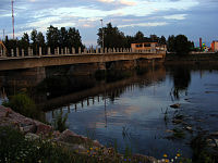
The town is characterized by the Kalajoki River, which runs SE–NW through the town centre. The agricultural and economical area of the Kalajoki river basin is known as Kalajokilaakso.
Ylivieska is situated along the Ostrobothnia railway, which leads from Helsinki, the national capital, to Rovaniemi in the north of the country. The railway was opened in 1886 and it has had a significant role in the town's economical development.
Economy
Employment by industry (2005)
- Services 66.1%
- Industry 28.5%
- Agriculture and forestry 5.4%
- Unemployment 11%
Agriculture and animal husbandry, mainly milking cows, used to be the main sources of livelihood in Ylivieska. In recent decades, the role of agriculture has reduced following the development of industry and services. Currently, Ylivieska is home to about 30 industrial enterprises, some of which are also internationally recognized in their respective niche markets.
Regionally, Ylivieska has become an important place for car buyers. There are several stores and agents selling new and used cars, and purchases average about 6,000 cars per year. Thus, the local car sales entrepreneurs have created the concept of Ylivieska being the "Autolaakso" or "car valley" of the Kalajokilaakso and neighbouring regions.
International relations
Twin towns — sister cities
Ylivieska is twinned with:[6]
 Voss, Norway
.svg.png) Walden (Greater Sudbury), Canada
Walden (Greater Sudbury), Canada
Friendship
 Viimsi, Estonia
Trivia
- The Home Region Museum of Ylivieska features traditional countryside lifestyle, some old buildings, and as a curiosity, a 700-piece collection of milk jugs, with jugs from 15 countries.
- Kyösti Kallio (1873–1940), the 4th President of Finland, was born in Ylivieska.
- The specialty foods of Ylivieska are maitorieska, a simple but tasty flat bread made of barley flour, milk and salt, and pepu, which only has the same ingredients as the maitorieska, but instead of being formed into flat breads and baked, pepu is boiled and pan fried. At the neighbouring municipality Sievi, a specialty food is mutti, which is actually unfried pepu.
- Ylivieska is the home of a spreading agricultural technology called moist grain crimping, developed in the late 1960s by two local brothers.
- Its church burned down on 26 March 2016.
References
- ^ "Area of Finnish Municipalities 1.1.2018" (PDF). National Land Survey of Finland. Retrieved 30 January 2018.
- ^ a b "Suomen virallinen tilasto (SVT): Väestön ennakkotilasto [verkkojulkaisu]. Joulukuu 2020" (in Finnish). Statistics Finland. Retrieved 11 February 2021.
- ^ "Population according to language and the number of foreigners and land area km2 by area as of 31 December 2008". Statistics Finland's PX-Web databases. Statistics Finland. Retrieved 29 March 2009.
- ^ "Population according to age and gender by area as of 31 December 2008". Statistics Finland's PX-Web databases. Statistics Finland. Retrieved 28 April 2009.
- ^ "List of municipal and parish tax rates in 2011". Tax Administration of Finland. 29 November 2010. Retrieved 13 March 2011.
- ^ "Kaupunki-info". ylivieska.fi (in Finnish). Ylivieska. Retrieved 2019-12-08.
External links
![]() Media related to Ylivieska at Wikimedia Commons
Media related to Ylivieska at Wikimedia Commons
- Town of Ylivieska – Official website
- Map of Ylivieska municipality
- Map of downtown Ylivieska
- The Home Region Museum of Ylivieska (in Finnish)
- Municipalities and administrative regions in Northern Ostrobothnia
- Oulu South region, regional development, tourism. etc. programmes
- Kalajokilaakso the local paper (in Finnish)
