| ||||
|---|---|---|---|---|
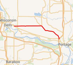 WIS 127 highlighted in red | ||||
| Route information | ||||
| Maintained by WisDOT | ||||
| Length | 14.16 mi[1] (22.79 km) | |||
| Major junctions | ||||
| West end | ||||
| East end | ||||
| Location | ||||
| Counties | Columbia | |||
| Highway system | ||||
| ||||
)
State Trunk Highway 127 (often called Highway 127, STH-127 or WIS 127) is a 14.16-mile (22.79 km) state highway in the U.S. state of Wisconsin. It runs from WIS 16 near Wisconsin Dells east to Interstate 39 (I-39) and WIS 16 in Portage; the highway is located entirely within Columbia County. WIS 127 is maintained by the Wisconsin Department of Transportation (WisDOT).
Route description
WIS 127 begins at a junction with WIS 16 and County Trunk Highway WD (CTF-WD) in the Town of Newport, southwest of Wisconsin Dells. From here, the highway heads east through farmland, crossing CTH-O. It enters the Town of Lewiston, passing to the south of Lake Corning. Past the lake, the route meets CTH-XX and CTF-AA in succession before turning southeast; the latter route connects WIS 127 to Briggsville. WIS 127 crosses a creek before turning east to pass Lewiston Elementary School. After crossing a second creek, the route again heads southeast toward Portage. The highway curves south to pass Columbia Correctional Institution, a maximum-security state prison, before entering Portage. In Portage, the route passes several businesses before terminating at a junction with WIS 16 and exit 89B on I-39.[2][3]
Major intersections
The entire route is in Columbia County.
| Location | mi[3] | km | Destinations | Notes | |
|---|---|---|---|---|---|
| Town of Newport | 0.0 | 0.0 | Western terminus | ||
| Portage | 14.1 | 22.7 | Eastern terminus | ||
| 1.000 mi = 1.609 km; 1.000 km = 0.621 mi | |||||
References
- ^ Bessert, Chris. "Wisconsin Highways: Highways 120-129 (Highway 127)". Wisconsin Highways. Retrieved 2007-03-20.
- ^ Columbia County (PDF) (Map). Wisconsin Department of Transportation. 2011. Retrieved January 29, 2012.
- ^ a b Google (January 29, 2012). "Overview map of Highway 127" (Map). Google Maps. Google. Retrieved January 29, 2012.