| ||||
|---|---|---|---|---|
| Bishop Grandin Boulevard | ||||
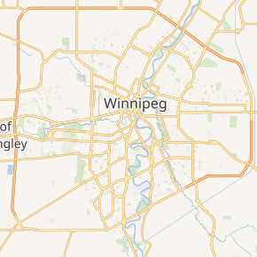 Route 165 highlighted in red | ||||
| Route information | ||||
| Maintained by City of Winnipeg | ||||
| Length | 10.9 km[2] (6.8 mi) | |||
| Existed | 1978[1]–present | |||
| Major junctions | ||||
| West end | Route 90 (Kenaston Blvd) | |||
| East end | PTH 59 / Route 20 (Lagimodiere Blvd) | |||
| Highway system | ||||
| Manitoba provincial highways Winnipeg City Routes
| ||||
)
Route 165 (locally known as Bishop Grandin Boulevard) is a highway in Winnipeg, Manitoba. Currently the route is an at-grade expressway running from an interchange with Kenaston Boulevard (Route 90) to Lagimodiere Boulevard (PTH 59 / Route 20). The route runs through the districts of Fort Garry, St. Vital, and St. Boniface.
The speed limit along the route is 80 km/h (50 mph).
The street was named for Vital-Justin Grandin. Bishop Grandin Boulevard first opened to traffic from Lagimodiere Boulevard (PTH 59 / Route 20) to Pembina Highway (Route 42) in 1978, with a westerly extension to Route 80 (Waverley Street) opening in 1990.[1]
Major intersections
From west to east:[3]
| Location | km[2] | mi | Destinations | Notes | |
|---|---|---|---|---|---|
| Fort Garry | 0.0 | 0.0 | Grade separated seagull intersection | ||
| 2.5 | 1.6 | ||||
| 2.9 | 1.8 | Partial cloverleaf interchange | |||
| Red River | 3.7 | 2.3 | Fort Garry Bridge | ||
| St. Vital | 4.0 | 2.5 | River Road | Split intersection | |
| 5.9 | 3.7 | ||||
| 6.4 | 4.0 | ||||
| 7.7 | 4.8 | ||||
| St. Boniface | 8.5 | 5.3 | Shorehill Drive | ||
| 9.2 | 5.7 | Lakewood Boulevard | |||
| 9.7 | 6.0 | Island Shore Boulevard | |||
| 10.3 | 6.4 | Boulevard de la Seigneurie | |||
| 10.9 | 6.8 | ||||
| 1.000 mi = 1.609 km; 1.000 km = 0.621 mi | |||||
See also
References
- ^ a b Goldsborough, Gordon (March 17, 2012). "Bishop Grandin Boulevard Plaque (Bishop Grandin Boulevard, Winnipeg)". Historic Sites of Manitoba. Government of Manitoba. Retrieved May 22, 2018.
- ^ a b Google (August 3, 2017). "Route 165 in Winnipeg" (Map). Google Maps. Google. Retrieved August 3, 2017.
- ^ Sherlock Publishing (2016). Sherlock's Map of Winnipeg (Map) (20th ed.). Winnipeg: Sherlock Publishing. pp. 25–27, 30–31. ISBN 1-895229-84-7.