West Maas en Waal | |
|---|---|
Municipality | |
) Church in Boven-Leeuwen | |
) Flag ) Coat of arms | |
.svg.gif')) Location in Gelderland | |
| Coordinates: 51°53′N 5°31′E / 51.883°N 5.517°E | |
| Country | Netherlands |
| Province | Gelderland |
| Established | 1984 |
| Government | |
| • Body | Municipal council |
| • Mayor | Vincent van Neerbos (PvdA) |
| Area | |
| • Total | 85.21 km2 (32.90 sq mi) |
| • Land | 76.76 km2 (29.64 sq mi) |
| • Water | 8.45 km2 (3.26 sq mi) |
| Elevation | 7 m (23 ft) |
| Population (January 2019)[4] | |
| • Total | 19,076 |
| • Density | 249/km2 (640/sq mi) |
| Time zone | UTC+1 (CET) |
| • Summer (DST) | UTC+2 (CEST) |
| Postcode | 6620–6621, 6626–6629, 6657–6659 |
| Area code | 0487 |
| Website | www |
West Maas en Waal () is a municipality in the Dutch province of Gelderland.
The municipality covers the western part of the Land van Maas en Waal, an island located between the Meuse and Waal rivers.
Population centres
- Alphen aan de Maas
- Altforst
- Appeltern
- Beneden-Leeuwen
- Boven-Leeuwen
- Dreumel
- Maasbommel
- Wamel
Topography
)
Dutch Topographic map of the municipality of West Maas en Waal, 2013.
Demographics
- Dutch: 93.6%
- Black people: 0.4%
- European: 4.7
- Arabs: 0.4%
- Other non-Western: 0.9%:[5]
Notable people
)
Samuel Story, 1811
- Samuel Story (1752 in Maasbommel – 1811) vice admiral of the Batavian Republic Navy
- Jona Lendering (born 1964 in Beneden-Leeuwen) historian and the author of books on antiquity, Dutch history and modern management
- Marco Pastors (born 1965 in Beneden-Leeuwen) civil servant and former politician
- Iris van Herpen (born 1984 in Wamel) fashion designer, known for fusing technology with traditional Couture craftsmanship
Sport
- Jan van Deinsen (born 1953) a retired football midfielder, 276 caps
- Ivo den Bieman (born 1967 in Wamel) retired footballer, played mainly in Scotland with about 260 caps
- Arno van Zwam (born 1969 in Beneden-Leeuwen) former football goalkeeper, over 300 caps
Gallery
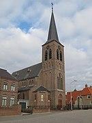
Appeltern, kerk
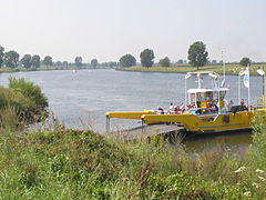
Ferry at the village of Lith
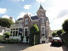
Beneden-Leeuwen, Quisisana Zandstraat
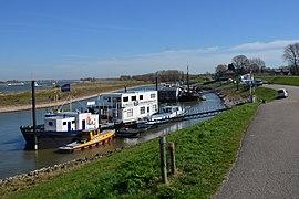
The Waalriver with a harbour and industrial activities
)
)
)
)
References
- ^ "College van burgemeester en wethouders" [Board of mayor and aldermen] (in Dutch). Gemeente West Maas en Waal. Retrieved 22 July 2014.
- ^ "Kerncijfers wijken en buurten 2020" [Key figures for neighbourhoods 2020]. StatLine (in Dutch). CBS. 24 July 2020. Retrieved 19 September 2020.
- ^ "Postcodetool for 6658AG". Actueel Hoogtebestand Nederland (in Dutch). Het Waterschapshuis. Retrieved 22 July 2014.
- ^ "Bevolkingsontwikkeling; regio per maand" [Population growth; regions per month]. CBS Statline (in Dutch). CBS. 1 January 2019. Retrieved 1 January 2019.
- ^ [1]
External links
 Media related to West Maas en Waal at Wikimedia Commons
- Official website