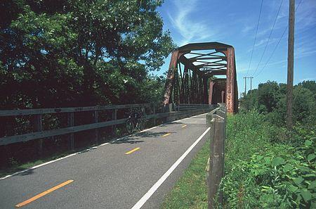
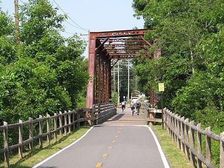
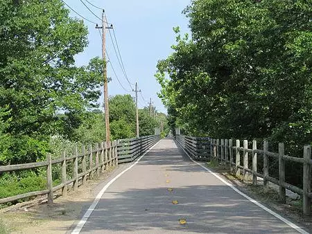
The Washington Secondary Rail Trail (also known as the Washington Secondary Bike Path) is a rail trail located in Rhode Island.
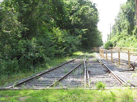
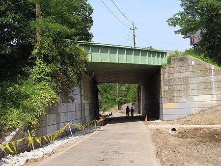
The trail measures 19 miles (31 km) [1] and has sections which are paved and unpaved. It runs along an abandoned rail corridor of the former Hartford, Providence & Fishkill Railroad.
The trail serves the communities of Coventry, West Warwick, Warwick, and Cranston.
Long-term plans envision the Washington Secondary Rail Trail connecting with the Blackstone River Bikeway, the East Bay Bike Path and the Moosup Valley State Park Trail in Connecticut.[2] The Washington Secondary Rail Trail is a designated section of the East Coast Greenway.
Coventry section
- Coventry
- distance 9.1 miles (14.6 km)
The Washington Secondary Bike Path starts near the Summit General Store on Log Bridge Road at the south/western paved end of the Coventry segment. West of this point, the trail is known as the Trestle Trail to the Ct state line. The pavement continues for 9.1 miles (14.6 km) north/east until the town line with West Warwick. Over the duration of the 4.0 paved miles, the Coventry greenway passes alongside the Flat River Reservoir, Knotty Oak Cemetery, the Merrill S. Whipple Conservation Area, and the upper branch of the Pawtuxet river over 4 bridges (3 water, 1 road, 1 of them a truss design). The path follows the direction of RI 117.
In 2014 the original Coventry Greenway section was rehabilitated and the 4.8 miles (7.7 km) Trestle Trail East section was added, extending the western end by almost five miles. Connecting the last section to the Connecticut border (and connection to the Moosup Valley State Park Trail) is planned which would bring the total length of the path to 24.0 miles (38.6 km).[3]
Trestle Trail Crossings (Unpaved)
| Crossing | Notes | Coordinates |
|---|---|---|
Border | Continuing on | 41°41′44″N 71°47′19″W / 41.6956°N 71.7886°W |
| Lewis Farm Rd. | 41°41′25″N 71°45′41″W / 41.6902°N 71.7615°W | |
| 41°41′23″N 71°44′49″W / 41.6896°N 71.7470°W | ||
| Unpaved Trail's End | 41°41′26″N 71°42′00″W / 41.6906°N 71.7001°W |
Paved Crossings
West Warwick section
- West Warwick
- distance 2.7 miles (4.3 km)
The trail is paved from the Coventry section to the Warwick leg. The right of way passes by the commercial district of Arctic. Along the trail are two mills, one commercial/industry, and one Residential (Royal Mills, Ace Dying Mill complex). Bradford Soap Works straddles the greenway not far after.
Crossings
| Crossings | Notes | Coordinates |
|---|---|---|
| Coventry/West Warwick town border | end of West Warwick segment of trail | 41°41′43″N 71°31′59″W / 41.6953°N 71.5330°W |
| Brookside Ave. | 41°42′04″N 71°31′28″W / 41.7010°N 71.5245°W | |
| Main St. | underpass | 41°42′07″N 71°31′24″W / 41.7020°N 71.5234°W |
| 41°42′29″N 71°31′18″W / 41.7081°N 71.5217°W | ||
| overpass | 41°42′50″N 71°31′12″W / 41.7138°N 71.5201°W | |
| Hay St. | 41°42′56″N 71°30′54″W / 41.7155°N 71.5150°W | |
| Pawtuxet River | river crossing | 41°42′54″N 71°30′43″W / 41.7150°N 71.5119°W |
| Private Dr. | 41°42′49″N 71°30′27″W / 41.7136°N 71.5074°W | |
| West Warwick/Warwick town border | end of West Warwick segment of trail | 41°42′42″N 71°30′01″W / 41.7118°N 71.5002°W |
Warwick section
- Warwick
- distance 1.57 miles (2.53 km)
It provides an almost direct connection to Bald Hill road and the Malls; (RI and Warwick). Another truss bridge is on the path nearby the West Warwick sewer treatment facility (the township line is nearby the greenway).
Crossings
| Crossings | Notes | Coordinates |
|---|---|---|
| West Warwick/Warwick town border | end of Warwick segment of trail | 41°42′42″N 71°30′01″W / 41.7118°N 71.5002°W |
| 41°42′42″N 71°30′01″W / 41.7118°N 71.5002°W | ||
| East Ave. | 41°43′14″N 71°29′14″W / 41.7206°N 71.4873°W | |
| Pawtuxet River | river crossing | 41°43′33″N 71°29′08″W / 41.7259°N 71.4856°W |
| underpass | 41°43′44″N 71°29′05″W / 41.7289°N 71.4847°W | |
| W. Natick Rd. | 41°43′44″N 71°29′05″W / 41.7289°N 71.4847°W | |
| Warwick/Cranston town border | end of Warwick segment of trail | 41°43′55″N 71°29′02″W / 41.7319°N 71.4838°W |
Cranston section
- Cranston
- distance 5.88 miles (9.46 km)
The longest paved section, the greenway passes through Oaklawn, Knightsville and the Gladstone sections of Cranston. The northern terminus at the moment ends at the northern end of Garfield avenue, at the Cranston Police department. The right of way, accessible almost up to the tracks continues north for .33 miles until it merges with Amtrak's Northeast Corridor.
Crossings
See also
- Blackstone River Bikeway
- East Bay Bike Path
- Greenways Alliance of Rhode Island
References
- ^ "Washington Secondary Bike Path - Rhode Island Rhode Island Department of Transportation". www.dot.ri.gov. Retrieved 2016-08-14.
- ^ "Moosup Valley State Park Trail | Connecticut Trails | TrailLink.com". www.traillink.com. Retrieved 2016-08-14.
- ^ "Washington Secondary Bike Path - Rhode Island Rhode Island Department of Transportation". www.dot.ri.gov. Retrieved 2016-08-14.
External links
- "Washington Secondary Bike Path". TrailLink. Rails-to-Trails Conservancy. Retrieved 15 June 2016.
