Wardrecques | |
|---|---|
_Église_Notre_Dame_(01).jpg')) The church of Wardrecques | |
Location of Wardrecques 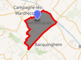 | |
) Wardrecques ) Wardrecques | |
| Coordinates: 50°42′40″N 2°20′41″E / 50.7111°N 2.3447°E | |
| Country | France |
| Region | Hauts-de-France |
| Department | Pas-de-Calais |
| Arrondissement | Saint-Omer |
| Canton | Fruges |
| Intercommunality | Pays de Saint-Omer |
| Government | |
| • Mayor (2014-2020) | Louis Cainne |
| Area 1 | 3.72 km2 (1.44 sq mi) |
| Population (Jan. 2017)[1] | 1,333 |
| • Density | 360/km2 (930/sq mi) |
| Time zone | UTC+01:00 (CET) |
| • Summer (DST) | UTC+02:00 (CEST) |
| INSEE/Postal code | 62875 /62120 |
| Elevation | 21–69 m (69–226 ft) (avg. 24 m or 79 ft) |
| 1 French Land Register data, which excludes lakes, ponds, glaciers > 1 km2 (0.386 sq mi or 247 acres) and river estuaries. | |
Wardrecques is a commune in the Pas-de-Calais department in the Hauts-de-France region of France.
Geography
Wardrecques is located 6 miles (9 km) southeast of Saint-Omer, on the D199 road, just a hundred yards from the Neufossé Canal.
Population
| Year | Pop. | ±% |
|---|---|---|
| 2006 | 1,153 | — |
| 2007 | 1,153 | +0.0% |
| 2008 | 1,153 | +0.0% |
| 2009 | 1,163 | +0.9% |
| 2010 | 1,174 | +0.9% |
| 2011 | 1,185 | +0.9% |
| 2012 | 1,189 | +0.3% |
| 2013 | 1,306 | +9.8% |
| 2014 | 1,315 | +0.7% |
| 2015 | 1,323 | +0.6% |
| 2016 | 1,331 | +0.6% |
Places of interest
- The church of Notre-Dame, dating from the sixteenth century.
- The eighteenth century Quenivet chapel.
See also
References
- ^ "Populations légales 2017". INSEE. Retrieved 6 January 2020.