| ||||
|---|---|---|---|---|
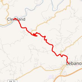 SR 82 highlighted in red | ||||
| Route information | ||||
| Maintained by VDOT | ||||
| Length | 6.84 mi[1] (11.01 km) | |||
| Existed | 1933–present | |||
| Major junctions | ||||
| West end | ||||
| East end | ||||
| Location | ||||
| Counties | Russell | |||
| Highway system | ||||
| ||||
)
State Route 82 (SR 82) is a primary state highway in central Russell County, Virginia, United States. Known as Cleveland Road for most of its length, the route runs 6.84 miles (11.01 km) from SR 600 (SR 600) and SR 661 (SR 661) in Cleveland to U.S. Route 19 Business (US 19 Business) in Lebanon, providing a mountain crossing connecting the two towns.
Route description
_just_northwest_of_Lebanon_in_Russell_County,_Virginia.jpg'))
SR 82 begins at the junction of SR 600 (Ivy Ridge Road) and SR 661 (Ivy Ridge Road) on the west bank of the Clinch River in Cleaveland. From its western terminus SR 82 heads easterly (as a two-lane road for its duration) on 1st Street to immediately cross over the river and then promptly turns northeast until it reaches Lebanon Avenue. The route then turns southeast on Lebanon Avenue and instantly crosses the Norfolk Southern Railway's Clinch Valley District tracks before passing through the central part of town. After leaving Cleveland the route follows an unnamed stream as it passes through the Cleveland Barrens Natural Area Preserve.
Continuing southeasterly as Cleveland Road, SR 82 crosses Reeds Valley before connecting with the north end of Jessees Mill Road (SR 645) and then west end of New Garden Road (also SR 645), both on the southeast edge of the valley. The route then begins is curvaceous assent of Copper Ridge, with several hairpin turns along the way. After reaching the crest of Copper Ridge (at just over 2,440 feet [740 m]), SR 82 begins its descent to Glade Hollow.
Before passing through the unincorporated community of Spring City, the route has a few more hairpin turns on its way down. Once in Spring City SR 82 connects with the west end of a section of SR 662. Halfway between Spring City and Glade Hollow, SR 82 connects with the east end of a section of SR 640 (which terminates at Jessees Road [SR 645]). Near its low point in Glade Hollow the route connects with the west end of another section of SR 645. On the southeast side of Glade Hollow, SR 82 climbs another, lower pass (less than 200 feet [61 m]) before dropping down into Lebanon. Once in town the route continues southerly (still as Cleveland Road) until it reaches its southern terminus at a T-intersection with Main Street (US 19 Business).[1][2]
History
All of SR 82 was added to the state highway system in 1932,[3] and the number 82 was assigned in the 1933 renumbering.
Major intersections
The entire route is in Russell County.
| Location | mi[1] | km | Destinations | Notes | |
|---|---|---|---|---|---|
| Cleveland | 0.00 | 0.00 | Western terminus | ||
| Bridge over the Clinch River | |||||
| | |||||
| | |||||
| Spring City | |||||
| | |||||
| | |||||
| Lebanon | 6.84 | 11.01 | Eastern terminus | ||
| 1.000 mi = 1.609 km; 1.000 km = 0.621 mi | |||||
See also
- List of state highways in Virginia
- List of highways numbered 82
References
- ^ a b c "2010 Traffic Data". Virginia Department of Transportation. 2009. Retrieved 2011-10-17.
- Russell County (PDF)
- ^ Google (2011-10-17). "Virginia State Route 82" (Map). Google Maps. Google. Retrieved 2011-10-17.
- ^ State Highway Commission of Virginia (July 27–29, 1932). Minutes of Meeting (PDF) (Report). Marion, Roanoke, and Richmond, VA: Commonwealth of Virginia. p. 14.
External links