Vertou | |
|---|---|
) The château du Portillon and the edge of the Sèvre Nantaise | |
.svg.gif')) Coat of arms | |
Location of Vertou 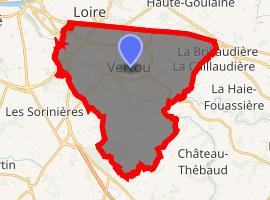 | |
) Vertou ) Vertou | |
| Coordinates: 47°10′08″N 1°28′11″W / 47.1689°N 1.4697°W | |
| Country | France |
| Region | Pays de la Loire |
| Department | Loire-Atlantique |
| Arrondissement | Nantes |
| Canton | Vertou |
| Intercommunality | Nantes Métropole |
| Government | |
| • Mayor (2020–2026) | Rodolphe Amailland |
| Area 1 | 35.68 km2 (13.78 sq mi) |
| Population (Jan. 2017)[1] | 24,219 |
| • Density | 680/km2 (1,800/sq mi) |
| Time zone | UTC+01:00 (CET) |
| • Summer (DST) | UTC+02:00 (CEST) |
| INSEE/Postal code | 44215 /44120 |
| Elevation | 1–56 m (3.3–183.7 ft) |
| 1 French Land Register data, which excludes lakes, ponds, glaciers > 1 km2 (0.386 sq mi or 247 acres) and river estuaries. | |
Vertou (French: [vɛʁtu] ) is a commune in the Loire-Atlantique department in western France.
It is located on the River Sèvre Nantaise, and was a historical town of Brittany.
Today, Vertou is a component of the Nantes Métropole and is the fifth-largest suburb of the city of Nantes, lying just southeast of Nantes.
Twin towns
 Morges, Vaud, Switzerland
 Poděbrady, Czech Republic
See also
References
- ^ "Populations légales 2017". INSEE. Retrieved 6 January 2020.
External links
- Official website (in French)