| |||||||
|---|---|---|---|---|---|---|---|
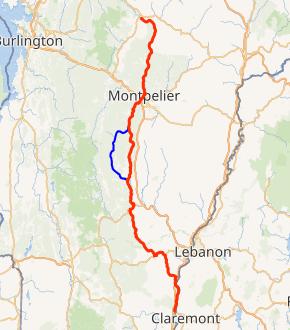 VT 12 highlighted in red, VT 12A in blue | |||||||
| Route information | |||||||
| Maintained by VTrans | |||||||
| Length | 101.627 mi[1] (163.553 km) | ||||||
| Existed | 1922–present | ||||||
| Major junctions | |||||||
| South end | |||||||
| |||||||
| North end | |||||||
| Location | |||||||
| Counties | Windsor, Orange, Washington, Lamoille | ||||||
| Highway system | |||||||
State highways in Vermont
| |||||||
)
Vermont Route 12 (VT 12) is a 101.627-mile-long (163.553 km) north-south state highway in Vermont that runs from Weathersfield to Morrisville.
Moose are most often encountered on four roads in Vermont, of which this is one. They are seen from Worcester to Elmore.[2]
Route description
Route 12 begins at the New Hampshire state line on the Connecticut River in the town of Weathersfield. It continues north along the west bank of the Connecticut River, overlapped with U.S. Route 5, until Hartland. It then heads northwest to Woodstock and then north through Montpelier to end at Vermont Route 15A in Morrisville. Vermont Route 12 runs parallel to Interstate 89 from the Woodstock/Hartford vicinity to Montpelier.
Major intersections
| County | Location[1] | mi[1] | km | Destinations | Notes |
|---|---|---|---|---|---|
| Windsor | Weathersfield | 0.000 | 0.000 | Continuation from New Hampshire | |
| 0.394 | 0.634 | Southern end of concurrency with US 5 | |||
| 1.544 | 2.485 | Southern terminus of VT 44A | |||
| Windsor | 5.412 | 8.710 | Eastern terminus of VT 44 | ||
| Hartland | 9.459 | 15.223 | Exit 9 on I-91; diamond interchange | ||
| 10.498 | 16.895 | Northern end of concurrency with US 5 | |||
| 18.203 | 29.295 | Southern end of concurrency with US 4 | |||
| Woodstock | 22.085 | 35.542 | Northern end of concurrency with US 4 | ||
| Bethel | 38.474 | 61.918 | Southern end of concurrency with VT 107 | ||
| 40.340 | 64.921 | Northern end of concurrency with VT 107 | |||
| Orange | Randolph | 48.413 | 77.913 | Southern terminus of VT 12A | |
| 48.528 | 78.098 | Western terminus of VT 66 | |||
| Brookfield | 58.932 | 94.842 | Western terminus of VT 65 | ||
| Washington | Northfield | 63.333 | 101.925 | Western terminus of VT 64 | |
| 64.457 | 103.733 | Northern terminus of VT 12A | |||
| Montpelier | 75.226 | 121.065 | Southern end of concurrency with US 2 Bus.; eastern terminus of US 2 Bus. | ||
| 75.430 | 121.393 | Northern end of concurrency with US 2 Bus. | |||
| Lamoille | Morristown | 101.627 | 163.553 | Northern terminus | |
1.000 mi = 1.609 km; 1.000 km = 0.621 mi
| |||||
Vermont Route 12A
| |
|---|---|
| Location | Randolph–Northfield |
| Length | 20.842 mi[1] (33.542 km) |
Vermont Route 12A is a state highway in central Vermont, United States. It provides an alternate route to VT 12 between Randolph and Northfield, via Braintree, Granville and Roxbury.
The road currently used by Vermont Route 12A was originally designated New England Interstate Route 12A as part of the New England Interstate Route System and existed as such until it was replaced by a different system in 1926.
Major intersections
| County | Location[1] | mi[1] | km | Destinations | Notes | |||
|---|---|---|---|---|---|---|---|---|
| Orange | Randolph | 0.000 | 0.000 | Southern terminus | ||||
| Addison | No major junctions | |||||||
| Washington | Roxbury | 14.854 | 23.905 | Warren Mountain Road | To | |||
| Northfield | 20.842 | 33.542 | Northern terminus | |||||
| 1.000 mi = 1.609 km; 1.000 km = 0.621 mi | ||||||||
See also
- Vermont Route 14 - The northernmost section used to be New England Route 12B
References
- ^ a b c d e f Traffic Research Unit (May 2013). "2012 (Route Log) AADTs for State Highways" (PDF). Policy, Planning and Intermodal Development Division, Vermont Agency of Transportation. Retrieved March 10, 2015.
- ^ "Drivers warned about moose". Florida Today. Melbourne, Florida. Associated Press. May 8, 2013. pp. 8A.