Verchin | |
|---|---|
) The church of Verchin | |
) Coat of arms | |
Location of Verchin 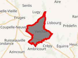 | |
) Verchin ) Verchin | |
| Coordinates: 50°29′43″N 2°11′07″E / 50.4953°N 2.1853°E | |
| Country | France |
| Region | Hauts-de-France |
| Department | Pas-de-Calais |
| Arrondissement | Montreuil |
| Canton | Fruges |
| Intercommunality | CC Haut Pays du Montreuillois |
| Government | |
| • Mayor (2008–2014) | Gilles De Lencquesaing |
| Area 1 | 10.68 km2 (4.12 sq mi) |
| Population (Jan. 2017)[1] | 241 |
| • Density | 23/km2 (58/sq mi) |
| Time zone | UTC+01:00 (CET) |
| • Summer (DST) | UTC+02:00 (CEST) |
| INSEE/Postal code | 62843 /62310 |
| Elevation | 88–171 m (289–561 ft) (avg. 102 m or 335 ft) |
| 1 French Land Register data, which excludes lakes, ponds, glaciers > 1 km2 (0.386 sq mi or 247 acres) and river estuaries. | |
Verchin is a commune in the Pas-de-Calais department in the Hauts-de-France region of France.
Geography
Verchin is located 20 miles (32 km) east of Montreuil-sur-Mer on the D93 road.
Population
The inhabitants are called Verchinois.
| Year | 1962 | 1968 | 1975 | 1982 | 1990 | 1999 | 2006 |
|---|---|---|---|---|---|---|---|
| Population | 302 | 303 | 276 | 250 | 220 | 220 | 194 |
| From the year 1962 on: No double counting—residents of multiple communes (e.g. students and military personnel) are counted only once. | |||||||
Places of interest
- The Château, dating from the sixteenth century
- The seventeenth century presbytery.
- The flamboyant gothic church of St. Omer, dating from the seventeenth century, with its twisted spire, caused by the use of unseasoned timber.
)
See also
References
- ^ "Populations légales 2017". INSEE. Retrieved 6 January 2020.