Varel | |
|---|---|
) Pedestrian area in Varel | |
) Coat of arms | |
Location of Varel within Friesland district 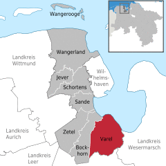 | |
) Varel ) Varel | |
| Coordinates: 53°23′49″N 08°08′10″E / 53.39694°N 8.13611°E | |
| Country | Germany |
| State | Lower Saxony |
| District | Friesland |
| Subdivisions | 32 districts |
| Government | |
| • Mayor | Gerd-Christian Wagner (SPD) |
| Area | |
| • Total | 113.53 km2 (43.83 sq mi) |
| Highest elevation | 12 m (39 ft) |
| Lowest elevation | 0 m (0 ft) |
| Population (2019-12-31)[1] | |
| • Total | 24,017 |
| • Density | 210/km2 (550/sq mi) |
| Time zone | UTC+01:00 (CET) |
| • Summer (DST) | UTC+02:00 (CEST) |
| Postal codes | 26316 |
| Dialling codes | 04451 |
| Vehicle registration | FRI |
| Website | www.varel.de |
Varel ([ˈfaːʁəl]) is a town in the district of Friesland, in Lower Saxony, Germany. It is situated near the Jade River and the Jade Bight, approximately 15 kilometres (9.3 mi) south of Wilhelmshaven and 30 kilometres (19 mi) north of Oldenburg.
Castle church
The castle church is the oldest building in Varel. The first part of the church is believed to have been built in 1144.[2] The tower was added between 1200 and 1250, originally as twin towers, which were rebuilt in today's form first in 1651 and then in 1737. The altar, font and pulpit were carved in 1613 – 1618 by Ludwig Münstermann. The altar is nearly 10 metres (33 ft) high and is one of the main works of Northern German Mannerism.
Before the Protestant Reformation, the patron saint was Saint Peter. Today, the castle church is a Lutheran church, with no patron saint. The church was formerly one of the buildings of the castle, which was demolished in the 19th century soon after a fire destroyed most parts of it.
Notable natives
- Charlotte Sophie Bentinck (1715-1800), confidante of Voltaire and Frederick the Great
- Johann Gerhard Oncken (1800-1884), founder of the German and continental European Baptist churches
- Lothar Meyer (1830-1895) developed about the same time and independent of Dmitri Mendeleev modern periodic table of the elements
- Oskar Emil Meyer (1834-1909), physicist
- Frederick Ludwig Hoffman (1865-1946), statistician
- Wilhelm Hegeler (1870-1943), writer
- Carl Carls (1880-1958), chess champion
- Erich Heckel (1883-1979), painter
- Karl Schmidt-Rottluff (1884-1976), expressionist painter and printmaker
- Friedrich Wegener (1907-1990), pathologist
- Hildegard Behrens (1937-2009), singer (dramatic soprano)
- Hans-Paul Bürkner (born 1951), CEO of the Boston Consulting Group
- Heiko Daxl (1957-2012), media artist, exhibition curator, art gallery owner and design / art collector
- Ines Varenkamp (born 1963), cyclist
- Markus Eichler (born 1982), cyclist
- Massiv in Mensch (founded in 1996), industrial musical duo
International relations
Varel is twinned with:
References
- ^ Landesamt für Statistik Niedersachsen, LSN-Online Regionaldatenbank, Tabelle 12411: Fortschreibung des Bevölkerungsstandes, Stand 31. Dezember 2019.
- ^ "Archived copy". Archived from the original on 2016-03-04. Retrieved 2016-03-04.
- ^ Greater Jackson Chamber of Commerce Archived 2011-07-26 at the Wayback Machine, 5 June 2002; retrieved on 11 September 2009.
External links
- Official site (in German)