Tumbler Ridge Airport | |||||||||||
|---|---|---|---|---|---|---|---|---|---|---|---|
| Summary | |||||||||||
| Airport type | Public | ||||||||||
| Operator | District of Tumbler Ridge | ||||||||||
| Location | Tumbler Ridge, British Columbia | ||||||||||
| Time zone | MST (UTC−07:00) | ||||||||||
| Elevation AMSL | 3,060 ft / 933 m | ||||||||||
| Coordinates | 55°01′38″N 120°55′52″W / 55.02722°N 120.93111°W | ||||||||||
| Map | |||||||||||
| Runways | |||||||||||
| |||||||||||
Source: Canada Flight Supplement[1] | |||||||||||
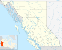
Tumbler Ridge Airport, (IATA: TUX, TC LID: CBX7), is located 6 nautical miles (11 km; 6.9 mi) south of Tumbler Ridge, British Columbia, Canada.
References
- ^ Canada Flight Supplement. Effective 0901Z 16 July 2020 to 0901Z 10 September 2020.
