Tramonti di Sopra | |
|---|---|
| Comune di Tramonti di Sopra | |
) Coat of arms | |
Location of Tramonti di Sopra 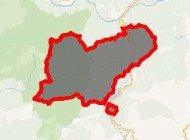 | |
) Tramonti di Sopra Location of Tramonti di Sopra in Italy ) Tramonti di Sopra Tramonti di Sopra (Friuli-Venezia Giulia) | |
| Coordinates: 46°19′N 12°48′E / 46.317°N 12.800°E | |
| Country | Italy |
| Region | Friuli-Venezia Giulia |
| Province | Pordenone (PN) |
| Frazioni | Maleon, Chievolis |
| Government | |
| • Mayor | Antonino Titolo |
| Area | |
| • Total | 123.9 km2 (47.8 sq mi) |
| Elevation | 420 m (1,380 ft) |
| Population (31 December 2010)[3] | |
| • Total | 385 |
| • Density | 3.1/km2 (8.0/sq mi) |
| Demonym(s) | Tramontini |
| Time zone | UTC+1 (CET) |
| • Summer (DST) | UTC+2 (CEST) |
| Postal code | 33090 |
| Dialing code | 0427 |
| Website | Official website |
Tramonti di Sopra (Friulian: Tramonç Disore, local variant Vildisora) is a comune (municipality) in the Province of Pordenone in the Italian autonomous region Friuli-Venezia Giulia, located about 110 kilometres (68 mi) northwest of Trieste and about 40 kilometres (25 mi) northeast of Pordenone.
Tramonti di Sopra is the traditional home of the "pitina", a particular meat ball, smoked with aromas and herbs (i.e. juniper). Other local food include "Formaj dal CIt", a typical cottage cheese flavour with pepper.
Tramonti di Sopra borders the following municipalities: Claut, Forni di Sotto, Frisanco, Meduno, Socchieve, Tramonti di Sotto.
References
- ^ "Superficie di Comuni Province e Regioni italiane al 9 ottobre 2011". Istat. Retrieved 16 March 2019.
- ^ "Popolazione Residente al 1° Gennaio 2018". Istat. Retrieved 16 March 2019.
- ^ All demographics and other statistics: Italian statistical institute Istat.