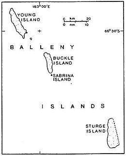
 Sturge Island is the southernmost of the Balleny Islands | |
| Geography | |
|---|---|
| Location | Antarctica |
| Coordinates | 67°25′S 164°44′E / 67.417°S 164.733°E |
| Archipelago | Balleny Islands |
| Area | 437.2 km2 (168.8 sq mi) |
| Length | 37 km (23 mi) |
| Width | 12 km (7.5 mi) |
| Highest elevation | 1,524 m (5000 ft) |
| Highest point | Brown Peak |
| Administration | |
| Administered under the Antarctic Treaty System | |
| Demographics | |
| Population | 0 |
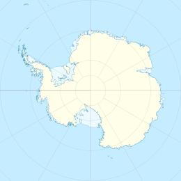
Sturge Island is one of the three main islands in the uninhabited Balleny Islands group located in the Southern Ocean. It lies 25 km (16 mi) southeast of Buckle Island and 95 km (59 mi) north-east of Belousov Point on the Antarctic mainland. The island, in Oates Land, also forms part of the Ross Dependency, claimed by New Zealand.
Description
The island is roughly a parallelogram in shape, with long east and west coasts and shorter coasts facing north-west and south-east. Of volcanic origin, it is about 12 km (7.5 mi) in width, with a maximum length of 37 km (23 mi),[1] between Cape Freeman in the north and Cape Smyth in the south. It is mostly covered by ice and snow throughout the year. The island's highest point reaches 1,524 m (5,000 ft)[2] with the unclimbed stratovolcano Brown Peak, the highest point in the Balleny chain.
Discovery and naming
The Balleny Islands were discovered by British mariner John Balleny in 1839. Sturge Island was named after Thomas Sturge, one of the London merchants who had financed Balleny's expedition.
Important Bird Area
A 4,655 ha site on the island has been designated an Important Bird Area (IBA) by BirdLife International because it supports extensive breeding colonies of southern fulmars and snow petrels on ice free cliffs along the western and northern coasts.[1]
See also
- Composite Antarctic Gazetteer
- Antarctic Treaty
- List of Antarctic and Subantarctic islands
- Thomas Sturge
References
- ^ a b "Sturge Island". BirdLife Data Zone. BirdLife International. 2015. Retrieved 30 November 2020.
- ^ "Brown Peak". SCAR Composite Gazetteer of Antarctica. Australian Antarctic Division. 2015. Retrieved 30 November 2020.
- W.E. LeMasurier; J.W. Thomson, eds. (1990). Volcanoes of the Antarctic Plate and Southern Oceans. American Geophysical Union. pp. 512 pp. ISBN 0-87590-172-7.
