Stari Jankovci | |
|---|---|
 | |
 | |
| Coordinates: 45°16′N 18°55′E / 45.267°N 18.917°E | |
| Country | |
| Region | Syrmia (Podunavlje) |
| County | |
| Government | |
| • Municipal mayor | Ivo Lozić (HDZ)[1] |
| Area | |
| • Municipality | 95.55 km2 (36.89 sq mi) |
| Population (2001) | |
| • Municipality | 1,769 |
| • Metro | 5,216 |
| Time zone | UTC+1 (CET) |
| • Summer (DST) | UTC+2 (CEST) |
| Postal code | |
| Area code(s) | 32 |
| Vehicle registration | VK |
| Website | o-jankovci.hr |
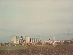
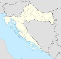
Stari Jankovci (Serbian Cyrillic: Стари Јанковци, Hungarian: Ivanóc) is a village in Vukovar-Syrmia County, Croatia, population 1,769 (2001), total municipality population 5,216 (2001), with 69.50% Croats, 23.24% Serbs and 5.06% Hungarians.
The village is located to the northeast of the Vinkovci-Tovarnik-Šid main road and railway route. The name Stari Jankovci means Old Jankovci, while to the southwest there is a smaller village of Novi Jankovci, meaning New Jankovci.
During the Croatian War of Independence, the village was occupied by the rebel Serbs in 1991. The parish church of Blessed Virgin Mary, built in 1780 with a notable Baroque-Classical main altar, was severely damaged.
Stari Jankovci is an underdeveloped municipality which is statistically classified as the First Category Area of Special State Concern by the Government of Croatia.[3]
Name
The name of the village in Croatian is in the plural, and therefore it is grammatically correct to refer to it as "Stari Jankovci are" instead of "Stari Jankovci is". A hypothetical singular version of the name would be Stari Jankovac.
History
Traces of continuous human settlement at the area of the municipality are investigated at two prehistoric settlements and one necropolis, one archaeological site from antiquity and medieval necropolis "Balkan".[2]
Municipality government
The municipality assembly is composed of 15 representatives. As of 2009, the member parties/lists are:[1]
| Party | Number of votes | Number of seats | |
|---|---|---|---|
| Croatian Democratic Union | 611 | 5 | |
| Independent Democratic Serb Party | 433 | 3 | |
| Croatian Peasant Party | 356 | 3 | |
| Independent municipal list-Tado Antukić | 291 | 2 | |
| Croatian Democratic Alliance of Slavonia and Baranja | 132 | 1 | |
| Croatian Party of Rights | 115 | 1 |
Villages
- Stari Jankovci
- Novi Jankovci
- Srijemske Laze
- Slakovci
- Orolik
- Jankovci railway station
References
- ^ a b "Informacija o rezultatima izbora članova predstavničkih tijela jedinica lokalne i područne (regionalne) samouprave" (PDF). Retrieved 2013-03-10.
- ^ a b "Općine na područjima posebne državne skrbi Republike Hrvatske" (PDF). Croatian Chamber of Economy. Retrieved 15 April 2020.
- ^ Lovrinčević, Željko; Davor, Mikulić; Budak, Jelena (June 2004). "AREAS OF SPECIAL STATE CONCERN IN CROATIA- REGIONAL DEVELOPMENT DIFFERENCES AND THE DEMOGRAPHIC AND EDUCATIONAL CHARACTERISTICS". Ekonomski pregled, Vol.55 No.5-6. Retrieved 25 August 2018.

