St. Cloud Regional Airport | |||||||||||||||
|---|---|---|---|---|---|---|---|---|---|---|---|---|---|---|---|
 | |||||||||||||||
| Summary | |||||||||||||||
| Airport type | Public | ||||||||||||||
| Owner | City of St. Cloud | ||||||||||||||
| Serves | St. Cloud, Minnesota | ||||||||||||||
| Elevation AMSL | 1,031 ft / 314 m | ||||||||||||||
| Coordinates | 45°32′48″N 094°03′36″W / 45.54667°N 94.06000°W | ||||||||||||||
| Website | www.StCloudAirport.com | ||||||||||||||
| Map | |||||||||||||||
| Runways | |||||||||||||||
| |||||||||||||||
| Statistics | |||||||||||||||
| |||||||||||||||
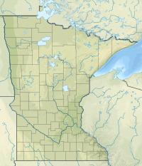
St. Cloud Regional Airport (IATA: STC, ICAO: KSTC, FAA LID: STC) is a city-owned, public-use airport in Sherburne County, Minnesota, United States.[2] It is located four nautical miles (5 mi, 7 km) east of the central business district of the city of St. Cloud, which owns and operates the airport.[2] The airport serves private, commercial, corporate, cargo and military operations. Mostly used for general aviation, it is also served by two commercial airlines.
This airport is included in the National Plan of Integrated Airport Systems for 2017–2021, which categorized it as a primary commercial service airport. As per Federal Aviation Administration records, the airport had 20,161 passenger boardings (enplanements) in calendar year 2008, 14,294 enplanements in 2009, and 1,198 in 2010. Mesaba Airlines, operating flights for Delta Connection, ended service to Minneapolis/St. Paul on December 31, 2009. Allegiant Air began service to Phoenix on December 15, 2012. SkyWest Airlines, operating as United Express, operated flights from St. Cloud to Chicago O'Hare International Airport from May 2014 to April 2015. The flights were suspended due to "poor performance in the market."[3]
Facilities and aircraft
St. Cloud Regional Airport covers an area of 1,414 acres (572 ha) at an elevation of 1,031 feet (314 m) above mean sea level. It has two runways: 13/31 is 7,000 by 150 feet (2,134 x 46 m) with a concrete surface and 5/23 is 3,000 by 75 feet (914 x 23 m) with an asphalt surface.[2]
For the 12-month period ending September 30, 2015, the airport had 28,740 aircraft operations, an average of 79 per day: 84% general aviation, 13% military, 1% air taxi and 2% scheduled commercial. In January 2017, there were 92 aircraft based at this airport: 63 single-engine, 12 military, 13 jet, 3 multi-engine and 1 helicopter.[2]
Airlines and destinations
| Airlines | Destinations | Refs |
|---|---|---|
| Allegiant Air | Seasonal: Destin/Fort Walton Beach (begins June 6, 2021),[4] Phoenix/Mesa, Punta Gorda (FL) | [5] |
| Destinations map |
|---|
(Green) = Seasonal Destination |
Statistics
| Rank | Airport | Passengers | Carriers |
|---|---|---|---|
| 1 | Phoenix/Mesa, AZ | 12,000 | Allegiant |
| 2 | Punta Gorda, FL | 4,000 | Allegiant |
History
In 2020 the airport received a $1,092,430 CARES Act award.[7][8]
References
- ^ https://www.transtats.bts.gov/airports.asp?pn=1&Airport=STC&Airport_Name=St.%20Cloud,%20MN:%20St.%20Cloud%20Regional&carrier=FACTS
- ^ a b c d e FAA Airport Form 5010 for STC PDF. Federal Aviation Administration. Effective Jan 5, 2017.
- ^ "Airline to suspend Chicago flights in April". St. Cloud Times. St. Cloud Times. Retrieved 20 June 2017.
- ^ https://www.allegiantair.com/
- ^ "Allegiant Route Map". Allegiant Airlines. Retrieved January 31, 2020.
- ^ "St Cloud Regional (STC) Summary Statistics". Retrieved 28 February 2020.
- ^ Uren, Adam (April 15, 2020). "97 Minnesota airports receive federal bailout cash, here's how much they got". Retrieved June 14, 2020.
- ^ "U.S. Transportation Secretary Elaine L. Chao Announces $10 Billion in Relief for America's Airports". April 14, 2020. Retrieved June 14, 2020.
External links
- St. Cloud Regional Airport, official site
- St. Cloud Regional Airport at Minnesota DOT Airport Directory
- Aerial image as of April 1991 from USGS The National Map
- FAA Airport Diagram (PDF), effective January 28, 2021
- FAA Terminal Procedures for STC, effective January 28, 2021
- Resources for this airport:
- FAA airport information for STC
- AirNav airport information for KSTC
- ASN accident history for STC
- FlightAware airport information and live flight tracker
- NOAA/NWS weather observations: current, past three days
- SkyVector aeronautical chart, Terminal Procedures


