| South Ealing | |
|---|---|
 | |
| Location | Ealing |
| Local authority | London Borough of Ealing |
| Managed by | London Underground |
| Number of platforms | 4 |
| Fare zone | 3 |
| London Underground annual entry and exit | |
| 2015 | |
| 2016 | |
| 2017 | |
| 2018 | |
| 2019 | |
| Railway companies | |
| Original company | District Railway |
| Key dates | |
| 1 May 1883 | Station opened |
| 29 April 1935 | Piccadilly line service introduced |
| 1964 | District line service withdrawn |
| Other information | |
| External links | |
| WGS84 | 51°30′04″N 0°18′26″W / 51.50111°N 0.30722°W |
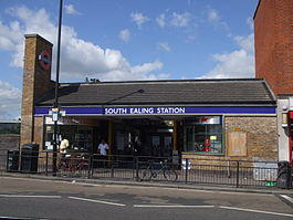
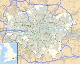
South Ealing tube station is a London Underground station in the London Borough of Ealing. The station is on the Heathrow Airport branch of the Piccadilly line, between Acton Town and Northfields stations.[4] It is located on South Ealing Road and is in Travelcard Zone 3.[4]
Station information
South Ealing tube station has a waiting room.[5]
The station does not offer step-free access from the train or platform to street level.[4]
Like all other London Underground stations, South Ealing has a Labyrinth artwork by Mark Wallinger, in place since 2013.[6]
Connections
London Buses routes 65 and N65 serve the station.[7]
History
South Ealing station was opened as a stop on the District Railway (later the District line) on 1 May 1883. These trains were initially steam-powered, but the line has been electrified since 1905.
The station has been served by the Piccadilly line since 29 April 1935. It was modernised between 1935-6, with the original buildings replaced, the eastbound platform receiving a new concrete canopy and waiting room and electric lights being installed.[8]
The District line service was withdrawn in 1964.[8]
The station building was again replaced in 1983.[8] It was refurbished once more in 2006.[6]
Gallery
References
- ^ a b c "Multi-year station entry-and-exit figures (2007–2017)" (XLSX). London Underground station passenger usage data. Transport for London. January 2018. Retrieved 22 July 2018.
- ^ "Station Usage Data" (CSV). Usage Statistics for London Stations, 2018. Transport for London. 21 August 2019. Retrieved 27 April 2020.
- ^ "Station Usage Data" (XLSX). Usage Statistics for London Stations, 2019. Transport for London. 23 September 2020. Retrieved 9 November 2020.
- ^ a b c Standard Tube Map (PDF) (Map). Not to scale. Transport for London. May 2020. Archived (PDF) from the original on 16 January 2021. Retrieved 16 January 2021.
- ^ "South Ealing Underground Station". Transport for London. Retrieved 28 March 2020.
- ^ a b "Labyrinth 260/270 - South Ealing". art.tfl.gov.uk. Retrieved 28 March 2020.
- ^ "Avoiding stairs Tube guide" (PDF). Transport for London. May 2019. Archived (PDF) from the original on 14 September 2019.
- ^ a b c Wallinger, Mark (2014). Labyrinth - A Journey Through London’s Underground. Art / Books. p. 287. ISBN 978-1-908970-16-9.
External links
- "South Ealing". Photographic Archive. London Transport Museum. Archived from the original on 10 February 2014.
| Preceding station | Following station | |||
|---|---|---|---|---|
| Piccadilly line | towards Cockfosters | |||
| Former services | ||||
| Preceding station | Following station | |||
towards Hounslow Town or Hounslow West | District line (1883–1908) | towards Upminster | ||
towards Hounslow Town or Hounslow West | District line (1908–1964) | |||


.jpg)
