Sarre-Union | |
|---|---|
) The town hall in Sarre-Union | |
) Coat of arms | |
Location of Sarre-Union 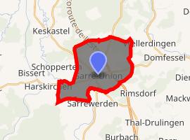 | |
) Sarre-Union ) Sarre-Union | |
| Coordinates: 48°56′N 7°05′E / 48.94°N 7.09°E | |
| Country | France |
| Region | Grand Est |
| Department | Bas-Rhin |
| Arrondissement | Saverne |
| Canton | Ingwiller |
| Government | |
| • Mayor (2008–2014) | Marc Séné |
| Area 1 | 15.39 km2 (5.94 sq mi) |
| Population (Jan. 2017)[1] | 2,823 |
| • Density | 180/km2 (480/sq mi) |
| Time zone | UTC+01:00 (CET) |
| • Summer (DST) | UTC+02:00 (CEST) |
| INSEE/Postal code | 67434 /67260 |
| Elevation | 217–330 m (712–1,083 ft) |
| 1 French Land Register data, which excludes lakes, ponds, glaciers > 1 km2 (0.386 sq mi or 247 acres) and river estuaries. | |
Sarre-Union (German: Saarunion) is a commune in the Bas-Rhin department in Grand Est in north-eastern France.
It consists of two older towns that were unified on 16 June 1794. On the east bank of the Sarre river is the town of Bouquenom (German: Bockenheim) and on the west bank the town of Ville Neuve de Sarrewerden (German: Neu-Saarwerden).[2] It was renamed Saar-Buckenheim between 1940 and 1944 during Nazi Germany occupation.
See also
References
- ^ "Populations légales 2017". INSEE. Retrieved 6 January 2020.
- ^ Sarre-Union on Quid.fr Archived 2008-10-13 at the Wayback Machine