Sant'Angelo Muxaro | |
|---|---|
| Comune di Sant'Angelo Muxaro | |
) | |
Location of Sant'Angelo Muxaro 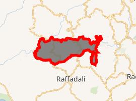 | |
) Sant'Angelo Muxaro Location of Sant'Angelo Muxaro in Italy ) Sant'Angelo Muxaro Sant'Angelo Muxaro (Sicily) | |
| Coordinates: 37°28′15″N 13°32′47″E / 37.47083°N 13.54639°E | |
| Country | Italy |
| Region | Sicily |
| Province | Agrigento (AG) |
| Government | |
| • Mayor | Lorenzo Alfano |
| Area | |
| • Total | 64.55 km2 (24.92 sq mi) |
| Elevation | 335 m (1,099 ft) |
| Population (30 November 2016)[3] | |
| • Total | 1,330 |
| • Density | 21/km2 (53/sq mi) |
| Demonym(s) | Santangelesi |
| Time zone | UTC+1 (CET) |
| • Summer (DST) | UTC+2 (CEST) |
| Postal code | 92020 |
| Dialing code | 0922 |
| Patron saint | St. Angelus of Jerusalem |
| Saint day | August 16 |
| Website | Official website |
Sant'Angelo Muxaro (Sicilian: Sant'Àngilu Muxaru) is a comune (municipality) in the Province of Agrigento in the Italian region Sicily, located about 70 kilometres (43 mi) south of Palermo and about 20 kilometres (12 mi) north of Agrigento.
History
Four gold and silver bowls dating from 650-600 BC were found in a tomb in the vicinity of the village in the 18th Century. Only one gold bowl remains, now in the British Museum's collection. The BM's phiale is decorated with 6 striding bulls and has become a symbol of Sant'Angelo Muxaro.[4]
Following the Ottoman invasion of Albania in the late fifteenth century, the present town was colonized by Albanian refugees. The centre of the town was founded in 1506[5] with further building in 1511. The town retained a distinct Italo-Albanian or Arbëreshë culture for many years. In the early 17th century the town was still an Arbëreshë settlement but now the Arbëresh language has disappeared from usage.
In 1600, the barony was acquired by the Princes of Castelvetrano, D'Aragona and Tagliavia and finally came under the jurisdiction of Pignatelli, Dukes of Monteleone, who kept it until 1812, when feudalism was suppressed in Sicily.
Geography
Sant'Angelo Muxaro borders the following municipalities: Agrigento, Alessandria della Rocca, Aragona, Casteltermini, Cattolica Eraclea, Cianciana, Raffadali, San Biagio Platani, Santa Elisabetta.
References
- ^ "Superficie di Comuni Province e Regioni italiane al 9 ottobre 2011". Istat. Retrieved 16 March 2019.
- ^ "Popolazione Residente al 1° Gennaio 2018". Istat. Retrieved 16 March 2019.
- ^ All demographics and other statistics: Italian statistical institute Istat.
- ^ British Museum Collection
- ^ https://www.gentracer.com/santangelomuxaro.html