The River Nadder is a tributary of the Salisbury Avon, flowing in south Wiltshire, England.
The river flows north from Ludwell to West End where it is joined by the Ferne Brook, close to the Lower Coombe and Ferne Brook Meadows[1] site of special scientific interest (SSSI).[2] At Wardour it is joined by the River Sem. The river then flows east through Tisbury, where it is joined by the Fonthill Brook, and then onto Barford St Martin and Burcombe before reaching Wilton.[3][4][5] Near Quidhampton, the Wylye joins from the north.[6] After passing Harnham, the Nadder joins the Avon near Salisbury Cathedral.[7]
Including its headwaters, the river's length is about 55 km (34 mi).[8][9][10][11]
Image gallery
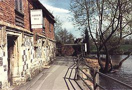
The Nadder at Teffont Mill
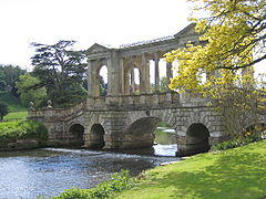
Flowing under the Palladian Bridge at Wilton House
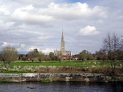
Salisbury Cathedral seen from the banks of the Nadder
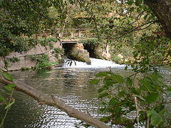
The watermill at Harnham is near where the Nadder meets the Avon
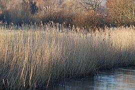
Reed beds along the banks of the Nadder at Harnham
)
)
)
)
)
References
- ^ "Lower Coombe and Ferne Brook Meadows" (PDF). naturalengland.org.uk. 25 January 2002. Retrieved 6 May 2019.
- ^ (PDF). 3 March 2016 https://web.archive.org/web/20160303221533/http://www.english-nature.org.uk/citation/citation_photo/2000393.pdf. Archived from the original (PDF) on 3 March 2016. Retrieved 6 May 2019.
- ^ "View: SU03 (includes: Wilton) - Ordnance Survey 1:25,000 maps of Great Britain, 1937-1961". National Library of Scotland. Retrieved 6 February 2018.
- ^ "Development Brief, Hindon Lane, Tisbury" (PDF). wiltshire.gov.uk. 2006. Retrieved 6 May 2019.
- ^ Wiltshire Archaeological and Natural History Society. Wiltshire archaeological and natural history magazine. London Natural History Museum Library. Devizes : Wiltshire Archaeological and Natural History Society.
- ^ "Wylye (lower)". Environment Agency - Catchment Data Explorer. Retrieved 7 February 2018.
- ^ "View: SU12 - Ordnance Survey 1:25,000 maps of Great Britain, 1937-1961". National Library of Scotland. Retrieved 6 February 2018.
- ^ "Nadder (headwaters)". Environment Agency - Catchment Data Explorer. Retrieved 7 February 2018.
- ^ "Nadder (upper)". Environment Agency - Catchment Data Explorer. Retrieved 7 February 2018.
- ^ "Nadder (middle)". Environment Agency - Catchment Data Explorer. Retrieved 7 February 2018.
- ^ "Nadder (lower)". Environment Agency - Catchment Data Explorer. Retrieved 7 February 2018.
External links
- Discover Nadder - Cranborne Chase AONB