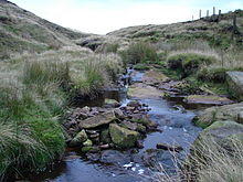
The River Laneshaw is a river in Northern England. It runs for 1.9 miles (3 km) from Laneshaw Reservoir to Laneshaw Bridge alongside the A6068 road[1] and has a catchment area of 5.1 square miles (13.2 km2).[2]
Rising as Laneshaw Brook on Combe Hill between the border of Lancashire and Yorkshire, the brook runs northwards, feeding first Laneshaw Reservoir then running westwards as the River Laneshaw.[3]
The River Laneshaw combines with Wycoller Beck at Covey Bridge to form Colne Water.[4]
References
- ^ "103" (Map). Blackburn & Burnley (C2 ed.). 1:50,000. Landranger. Ordnance Survey. 2006. ISBN 978-0-319-22829-6.
- ^ "Colne Water (Laneshaw)". Catchment Data Explorer. Environment Agency. Retrieved 16 October 2016.
- ^ Hull, Edward; Dakyn, J R; Tiddeman, R H; Ward, J C; Gunn, W (1875). The geology of the Burnley Coalfield and of the country around Clitheroe, Blackburn, Preston, Chorley, Haslingden, and Todmorden. London: HMSO. p. 12. OCLC 315448672.
- ^ Wilmore, A (2013). "6. Rivers". South Lancashire. Cambridge: Cambridge University Press. p. 24. ISBN 978-1-107-61616-5.
