| Rega | |
|---|---|
) Rega Basin | |
| Location | |
| Country | Poland |
| Physical characteristics | |
| Source | |
| • location | near Imienko |
| • elevation | 177.5 m (582 ft) |
| Mouth | |
• location | Baltic Sea |
• coordinates | 54°08′46″N 15°17′07″E / 54.1462°N 15.2854°E |
| Length | 188 km (117 mi) |
| Basin size | 2,767 km2 (1,068 sq mi) |
| Discharge | |
| • average | 21.1 m3/s (750 cu ft/s) |
| Basin features | |
| Progression | West then North |
| Tributaries | |
| • left | Ukleja, Stara Rega (river), Reska Węgorza |
| • right | Mołstowa, Rekowa |
The Rega is a river in north-western Poland, flowing into the Baltic Sea. It is the country's 24th longest river, with a total length of 188 km and a catchment area of 2,767 km².[1]
Towns
The following towns are situated on the Rega:
- Świdwin
- Łobez
- Resko
- Płoty
- Gryfice
- Trzebiatów
- Mrzeżyno
Tributaries
The following rivers are tributaries of the Rega:
- Brzeźnicka Węgorza
- Gardominka
- Mołstowa
Images
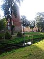
Świdwin
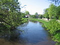
Łobez
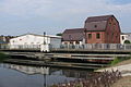
Resko
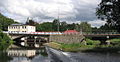
Płoty
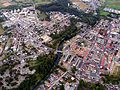
Gryfice
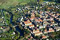
Trzebiatów
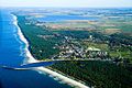
Mrzeżyno - (Baltic Sea)
)
)
)
)
)
)
)
References
- ^ Statistical Yearbook of the Republic of Poland 2017, Statistics Poland, p. 85-86
See also