Raye-sur-Authie | |
|---|---|
) The square of Raye-sur-Authie | |
) Coat of arms | |
Location of Raye-sur-Authie 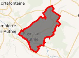 | |
) Raye-sur-Authie ) Raye-sur-Authie | |
| Coordinates: 50°17′55″N 1°56′57″E / 50.2986°N 1.9492°E | |
| Country | France |
| Region | Hauts-de-France |
| Department | Pas-de-Calais |
| Arrondissement | Montreuil |
| Canton | Auxi-le-Château |
| Intercommunality | CC Sept Vallées |
| Government | |
| • Mayor (2020–2026) | Monique Dufour |
| Area 1 | 5.89 km2 (2.27 sq mi) |
| Population (Jan. 2017)[1] | 250 |
| • Density | 42/km2 (110/sq mi) |
| Time zone | UTC+01:00 (CET) |
| • Summer (DST) | UTC+02:00 (CEST) |
| INSEE/Postal code | 62690 /62140 |
| Elevation | 12–101 m (39–331 ft) (avg. 16 m or 52 ft) |
| 1 French Land Register data, which excludes lakes, ponds, glaciers > 1 km2 (0.386 sq mi or 247 acres) and river estuaries. | |
Raye-sur-Authie is a commune in the Pas-de-Calais department in the Hauts-de-France region of France.
Geography
Raye-sur-Authie is located 15 miles (24 km) southeast of Montreuil-sur-Mer on the D119 road, on the river Authie, the border with the Somme department.
Population
| Year | Pop. | ±% p.a. |
|---|---|---|
| 1968 | 336 | — |
| 1975 | 317 | −0.83% |
| 1982 | 271 | −2.21% |
| 1990 | 259 | −0.56% |
| 1999 | 255 | −0.17% |
| 2007 | 232 | −1.17% |
| 2012 | 221 | −0.97% |
| 2017 | 250 | +2.50% |
| Source: INSEE[2] | ||
Places of interest
- The church of St.Liéphard, dating from the eighteenth century.
- A windmill
See also
References
- ^ "Populations légales 2017". INSEE. Retrieved 6 January 2020.
- ^ Population en historique depuis 1968, INSEE