Polincove | |
|---|---|
_mairie.jpg')) The town hall of Polincove | |
) Coat of arms | |
Location of Polincove 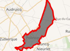 | |
) Polincove ) Polincove | |
| Coordinates: 50°51′05″N 2°05′32″E / 50.8514°N 2.0922°E | |
| Country | France |
| Region | Hauts-de-France |
| Department | Pas-de-Calais |
| Arrondissement | Calais |
| Canton | Marck |
| Intercommunality | Communauté de communes de la Région d'Audruicq |
| Government | |
| • Mayor (2020–2026) | Thierry Rouze |
| Area 1 | 4.75 km2 (1.83 sq mi) |
| Population (Jan. 2017)[1] | 853 |
| • Density | 180/km2 (470/sq mi) |
| Time zone | UTC+01:00 (CET) |
| • Summer (DST) | UTC+02:00 (CEST) |
| INSEE/Postal code | 62662 /62370 |
| Elevation | 1–21 m (3.3–68.9 ft) (avg. 12 m or 39 ft) |
| 1 French Land Register data, which excludes lakes, ponds, glaciers > 1 km2 (0.386 sq mi or 247 acres) and river estuaries. | |
Polincove is a commune in the Pas-de-Calais department in the Hauts-de-France region of France.
Geography
Polincove lies about 10 miles (16 km) southeast of Calais, at the junction of the D218 and D219 roads and by the banks of the river Hem.
Population
| Year | Pop. | ±% p.a. |
|---|---|---|
| 1968 | 395 | — |
| 1975 | 389 | −0.22% |
| 1982 | 416 | +0.96% |
| 1990 | 453 | +1.07% |
| 1999 | 560 | +2.38% |
| 2007 | 714 | +3.08% |
| 2012 | 799 | +2.28% |
| 2017 | 853 | +1.32% |
| Source: INSEE[2] | ||
Places of interest
- The church of St.Leger, dating from the eighteenth century.
See also
References
- ^ "Populations légales 2017". INSEE. Retrieved 6 January 2020.
- ^ Population en historique depuis 1968, INSEE
External links
- Polincove on the Insee website (in French)