| Pico do Arieiro | |
|---|---|
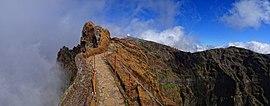
 View of Pico Do Arieiro from the west | |
| Highest point | |
| Elevation | 1,818 m (5,965 ft) [1] |
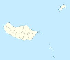
| Coordinates | 32°44′08″N 16°55′44″W / 32.73556°N 16.92889°W |
| Geography | |
| Location | Madeira |
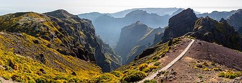
Pico do Arieiro, at 1,818 m (5,965 ft) high, is Madeira Island's third highest peak.[2] Most days, visitors can stand and look down on the clouds. The air is fresh and clear and the sun is very bright. On a clear day it is possible to see the neighbouring island of Porto Santo, 30 miles to the northeast.
The footpath northwards towards Pico Ruivo is an important tourist attraction, with a daily average of 1000 tourists trekking on it.
There is easy road access to the summit, with a large car park, a restaurant and souvenir shop. In 2011, an Air Defence Radar Station was built at the top of the mountain near the tourist facilities.

Climate
Pico do Areeiro has a cool Mediterranean climate, surprisingly wet for this type of climate due to the extreme precipitation it gets, a big part of it from drizzle and fog.
| Climate data for Pico do Areeiro, 1961-1990, 1,610 m (5,280 ft) altitude | |||||||||||||
|---|---|---|---|---|---|---|---|---|---|---|---|---|---|
| Month | Jan | Feb | Mar | Apr | May | Jun | Jul | Aug | Sep | Oct | Nov | Dec | Year |
| Average high °C (°F) | 8.1 (46.6) | 8.4 (47.1) | 9.0 (48.2) | 9.0 (48.2) | 11.4 (52.5) | 14.4 (57.9) | 18.5 (65.3) | 18.8 (65.8) | 16.1 (61.0) | 13.2 (55.8) | 10.4 (50.7) | 8.5 (47.3) | 12.1 (53.9) |
| Daily mean °C (°F) | 5.5 (41.9) | 5.6 (42.1) | 6.2 (43.2) | 6.1 (43.0) | 8.2 (46.8) | 11.0 (51.8) | 14.6 (58.3) | 14.8 (58.6) | 12.8 (55.0) | 10.3 (50.5) | 7.8 (46.0) | 6.0 (42.8) | 9.1 (48.3) |
| Average low °C (°F) | 2.9 (37.2) | 2.8 (37.0) | 3.4 (38.1) | 3.2 (37.8) | 5.0 (41.0) | 7.6 (45.7) | 10.7 (51.3) | 10.8 (51.4) | 9.5 (49.1) | 7.4 (45.3) | 5.2 (41.4) | 3.5 (38.3) | 6.0 (42.8) |
| Record low °C (°F) | −3.0 (26.6) | −4.3 (24.3) | −4.3 (24.3) | −6.0 (21.2) | −0.9 (30.4) | 1.0 (33.8) | 2.4 (36.3) | 4.3 (39.7) | 3.3 (37.9) | 0.0 (32.0) | −2.5 (27.5) | −3.0 (26.6) | −6.0 (21.2) |
| Average precipitation mm (inches) | 437.0 (17.20) | 371.6 (14.63) | 302.4 (11.91) | 211.3 (8.32) | 116.6 (4.59) | 69.8 (2.75) | 13.2 (0.52) | 33.5 (1.32) | 169.7 (6.68) | 306.8 (12.08) | 448.9 (17.67) | 447.0 (17.60) | 2,927.8 (115.27) |
| Source: [3] | |||||||||||||
References
- ^ Pico do Arieiro at peakbagger.com
- ^ Madeira Geography Archived 2011-07-14 at the Wayback Machine
- ^ Quintal, José Raimundo Gomes. "Estudo fitogeográfico dos jardins, parques e quintas do concelho do Funchal" (PDF). University of Lisbon. Retrieved 11 February 2021.
External links
![]() Media related to Pico do Areeiro at Wikimedia Commons
Media related to Pico do Areeiro at Wikimedia Commons

