Wikipedia

Pic de Sanfonts

Pic de Sanfonts
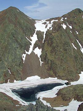
Estany Negre Pic de Sanfonts Agulla de Baiau.JPG
Pic de Sanfonts (left), Agulla de Baiau (right) and Estany Negre.
Highest point
Elevation2,894 m (9,495 ft)
Prominence150 m (490 ft)
Isolation1.18 km (0.73 mi) Edit this on Wikidata
to Coma Pedrosa Edit this on Wikidata
Coordinates42°36′0″N 1°26′43″E / 42.60000°N 1.44528°E
Geography
Pic de Sanfonts is located in Pyrenees
Pic de Sanfonts
Pic de Sanfonts
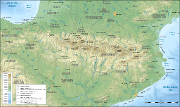
Location in the Pyrenees
LocationAndorra
Parent rangePyrenees

Pic de Sanfonts (Catalan pronunciation: [ˈpiɡ də səmˈfɔns]) is a mountain in the Pyrenees on the border of Spain and northwest Andorra. The nearest town is Arinsal, La Massana.[1] It is a subpeak of, and 1.2 km southwest of, Coma Pedrosa (2942 m), the highest mountain in Andorra.

References


This article is copied from an article on Wikipedia® - the free encyclopedia created and edited by its online user community. The text was not checked or edited by anyone on our staff. Although the vast majority of Wikipedia® encyclopedia articles provide accurate and timely information, please do not assume the accuracy of any particular article. This article is distributed under the terms of GNU Free Documentation License.

Copyright © 2003-2025 Farlex, Inc Disclaimer
All content on this website, including dictionary, thesaurus, literature, geography, and other reference data is for informational purposes only. This information should not be considered complete, up to date, and is not intended to be used in place of a visit, consultation, or advice of a legal, medical, or any other professional.