| Phu Hin Rong Kla National Park | |
|---|---|
| อุทยานแห่งชาติภูหินร่องกล้า | |
IUCN category II (national park) | |
) Landform | |
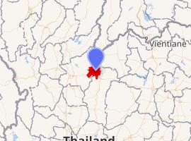 | |
| Location | Loei, Phitsanulok and Phetchabun Provinces, Thailand |
| Coordinates | 16°58′36″N 101°02′24″E / 16.97667°N 101.04000°E |
| Area | 307 km2 (119 sq mi) |
| Established | 1984 |
| Visitors | 289,210 (in 2019) |
| Governing body | Department of National Park, Wildlife and Plant Conservation (DNP) |
| Phitsanulok Wildlife |
|---|
| Endangered |
| Vulnerable |
| Near threatened |
| National Parks |
| Kaeng Chet Khwae |
Phu Hin Rong Kla National Park (Thai: อุทยานแห่งชาติภูหินร่องกล้า) is a national park located in the Loei, Phitsanulok and Phetchabun Provinces of Thailand. The protected area is located in the forested mountains of the Luang Prabang Range close to the border with Laos and is part of the Luang Prabang montane rain forests ecoregion.[1] The park was the base of operations of the long fight of Thai combatant in communist war of Thailand.
Topography
The park landscape is generally dominated by mountainous terrain. The northern part of the park stretches to the border with Laos. The southern part of the park extends into the Phetchabun Province. Mountain peaks include Phu Phang Ma, Phu Lom Lo and Phu Hin Rong Kla. The 1,768 metres (5,801 ft) high Phu Thap Boek is the highest mountain in the park in Loei province. The second tallest is Phu Lom Lo at an elevation of 1,664 metres (5,459 ft). Within the park are the sources of the Mueat Don and Luang Yai Rivers.[2]
History
Between 1968 and 1972, the area was the scene of fighting between Thai communist insurgents and the Royal Thai Armed Forces. Due to the difficult terrain, it was initially impossible to achieve success against the communists and tactics had to be changed. The military were able to convince the Hmong community present around the area to cooperate with the Thai government. This worked out perfectly and the communist insurgents surrendered without further bloodshed.
In February 1983, officials from the country's national park administration examined the area for the first time and found that there are many natural beauties here that made them suitable for a national park.
In 1984 the national park was opened as the 48th in the country. [3]
Climate
The park is generally cool all year round, with temperatures rarely rising above 25 °C (77 °F). The temperature occasionally drops below freezing.[2]
Flora
The park has mixed deciduous, dry dipterocarp, hill evergreen and pine forests.[2]
Dry Dipterocarp Forest[4]
The lower Mekong Dry Forest Ecoregion is characterized by a mosaic of habitats. The main forest type is deciduous forest. On higher quality soils or at higher elevation, areas of mixed deciduous forest and semi-evergreen forest occur. This mosaic of forest type is one of the reasons why such a large quantity and diversity of species are home to this landscape - the diverse forest patches act as key resource areas and refugia for a lot of wildlife.
Deciduous dipterocarp forests typically have an open canopy combined with a grassy understorey. Member of the forest's namesake family Dipterocarpaceae dominate the vegetation. While all other Dipterocarp-trees are evergreen, the six species in the dry forest are the only ones that lose their leaves during the dryer months of November to April. This is likely to be an adaptation to the region's climate with its strong, extended wet and dry seasons - shedding the leaves decreases the tree's surface area and reduces the amount of water that the trees lose due to transpiration.
Semi-evergreen forests have a taller and multilayered forest structure than deciduous dipterocarp forests. While such forest to lowland evergreen rain forest, they grow in areas with lower and more seasonal rainfall and are characterized by lower species diversity. Bamboos are common in the semi-evergreen forests of Cambodia's Eastern Plains Landscape, especially along seasonal waterways and after disturbance. Within the Dry Forest Ecoregion, semi-evergreen forest patches are essential in providing shelter to large mammals and key resources to many species.
Interspersed within these forests are seasonally inundated wetlands; natural clearings that provide sources of food and water for a wide variety if wildlife, especially during the latter stages of the dry season. These wetland, along with scattered permanent pools along seasonal river beds, form a crucial resource network throughout the Dry Forest Ecoregion, especially in the Eastern Plains and help to maintain many of its ecological processes.
Hill evergreen Forest[5]
This type of forest is less dense than the tropical evergreen forest because it has less large trees. This type of forest too is green all year round. The climate is quite cool because it is found at high altitudes. the hill evergreen forest is very important to the preservation of water sources.
Trees are mainly shrubs mixed with some pines. Smaller plants in the forest include ground orchids (Habenaria rdocheila, Phalaenopsis pulcherrima and Thunia alba) and other tropical plants such as wild roses, violets and lilacs (Caulokaempferia alba, C.saxicola and Impatiens musicola.[6] In addition there are small plants that grow on the larger trees such as moss and orchids.
Pine Forest[7]
There is only pine in the forest which is pine two leaves and three leaves. Normally pine forest grow lower than rainforest or same level as rainforest. In dry area can grow as well, but more than 200–1,800 metres (660–5,910 ft) from sea level. In Thailand pine forest mostly growth in Northern and East Northern part.
Fauna
At the present, humans come and settle down so there are less wild animals in the national park.
The number of sightings in the park are:[8]
Nine species of mammels, include:[8]
- Asian black bear
- Asian golden cat
- Barking deer
- Finlayson's squirrel
- Hog badger
- Indochinese serow
- Leopard
- Wild boar
One species of turtles in the park:[8]
Four species of lizards, include:[8]
- Barred flying dragon
- Brown pricklenape
Thirteen species of reptiles, include:[8]
- Mountain slug snake
- Green trinket snake
- Banded wolf snake
- Khasi keelback
Thirteen species of amphibians, include:[8]
- Small spadefoot toad
- Rhacophorus rhodopus
- Black-striped frog
- Somak's newt
The park has 222 species of birds, of which 165 species of passerines include:[8]
- Asian fairy-bluebird
- Black-naped monarch
- Black-naped oriole
- Blue pitta
- Bronzed drongo
- Common iora
- Common rosefinch
- Dusky crag martin
- Green cochoa
- Indochinese cuckooshrike
- Long-tailed broadbill
- Long-tailed shrike
- Mountain tailorbird
- Orange-bellied leafbird
- Oriental magpie-robin
- Oriental white-eye
- Red-throated pipit
- Scarlet-backed flowerpecker
- silver-eared laughingthrush
- Thick-billed warbler
- White-throated fantail
- Yellow-bellied sunbird
- Yellow-cheeked tit
- Yellow-vented bulbul
57 species of non-passerines include
Places
- Lan Hin Taek (ลานหินแตก) - a big broken stone sheet that looks similar to splitting land. It is covered with orchids, ferns, mosses, lichens and seasonal flowers.[9]
- Lan Hin Pum (ลานหินปุ่ม) - natural rock formations.
- Nam Tok Man Daeng (น้ำตกหมันแดง) - a 32-tiered waterfall of the Man creek that flows throughout the year.
- Nam Tok Rom Klao and Pharadon (น้ำตกร่มเกล้า-ภราดร) - waterfalls.
- Nam Tok Pha Lat (น้ำตกผาลาด) - waterfalls.
- Thailand-Communism museum.[10]
Effect of human presence
Much of the forest was damaged and much of the wildlife was killed or fled to safer areas during a period when the region was used as a battlefield between the Thai government and the communists.[2]
References
- ^ Luang Prabang montane rain forests
- ^ a b c d "Phu Hin Rong Kla National Park". Department of National Parks (Thailand). Archived from the original on 18 April 2016. Retrieved 29 May 2017.
- ^ "พระราชกฤษฎีกา กำหนดบริเวณที่ดินป่าภูหินร่องกล้า ในท้องที่ตำบลบ่อโพธ์ ตำบลเนินเพิ่ม ตำบลบ้านแยง อำเภอนครไทอ จังหวัดพิษณโลก และตำบลกกสะทอน อำเภอด่านช้าย จังหวัดเลย ให้เป็นอุทยานแหงชาติ. พ.ศ.๒๕๒๗" [Royal Decree: Set the area of Phu Hin Rong Kla forest in the area of Bo Pho subdistrict, Noen Phoem subdistrict, Ban Yaeng subdistrict, Nakhon Thai district, Phitsanulok province and Kok Sathon subdistrict, Dan sai district, Loei province to be a national park. B.E.2527 (1984)] (PDF). Royal Thai Government Gazette. 101 (96): 4–6. 26 July 1984. Retrieved 30 December 2020.
- ^ "dry dipterocarp". Archived from the original on 2015-05-21.
- ^ "hill evergreen". Archived from the original on 2017-07-28.
- ^ "The Best of national Parks of Thailand" (PDF). Department of National Parks, Wildlife and Plant Conservation. 2020. p. 39. Retrieved 30 December 2020.
- ^ "pine forest".
- ^ a b c d e f g "Phu Hin Rong Kla National Park". Department of National Parks, Wildlife and Plant Conservation. 2020. Retrieved 24 December 2020.
- ^ Phitsanulok at ThaiWebsites.com
- ^ Phitsanulok. Provincial Development Stategy Group Phitsanulok. 2005. pp. 85–94. ISBN 974-458-068-2.
External links
- "Luang Prabang montane rain forests". Terrestrial Ecoregions. World Wildlife Fund.