Pathari | |
|---|---|
Town | |
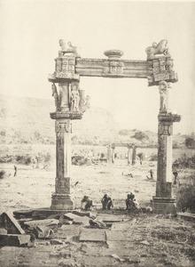
 Gadarmal Jain Temple | |
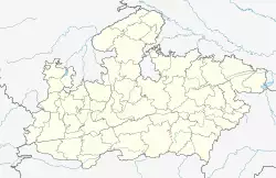
| Coordinates: 23°56′0″N 78°13′0″E / 23.93333°N 78.21667°E | |
| Country | India |
| State | Madhya Pradesh |
| District | Vidisha |
| Tehsil | Kurwai |
| Named for | Former princely state |
| Languages | |
| • Official | Hindi, English |
| Time zone | UTC+5:30 (IST) |
| PIN | 464337 |
| STD code | 07593 |
| Climate | Aw (Köppen) |
| Avg. summer temperature | 34 °C (93 °F) |
| Avg. winter temperature | 18 °C (64 °F) |
| Pathari - Climate-Data | |
Pathari is a town in Kurwai Tehsil, Vidisha district, in the Indian state of Madhya Pradesh.[1]
Geography
Pathari is located at 23°56′N 78°13′E / 23.933°N 78.217°E.[2] It is located close to a lake on a hillock with an elevation of 550 metres. There are ancient ruins and caves close to the town in an area known as Badoh-Pathari.[3][4]
History
A 1269 CE inscription of the Paramara king Jayavarman II was found at Pathari. It records the allotment of land for a religious rite. The inscription mentions Vaḍovyapattana, which is identified with the Badoh village near Pathari.[5]
During the British Raj era, Pathari was the capital of Pathari State, one of several princely states of the Central India Agency.[6]
Religious Importance
9th century built Gadarmal Jain Temple & vanmandir Jain Temple is situated here .
See also
- List of Monuments of National Importance in Madhya Pradesh/East
References
- ^ Pathari Block Panchayat List
- ^ Falling Rain Genomics, Inc - Pali
- ^ Photographs from the Pathari ruins (Madhya Pradesh, India)
- ^ Badoh Pathari
- ^ Harihar Vitthal Trivedi (1991). Inscriptions of the Paramāras (Part 2). Corpus Inscriptionum Indicarum Volume VII: Inscriptions of the Paramāras, Chandēllas, Kachchapaghātas, and two minor dynasties. Archaeological Survey of India. pp. 208–209. doi:10.5281/zenodo.1451755.
- ^ Imperial Gazetteer of India, v. 20, p. 29.
External links
 Media related to Pathari at Wikimedia Commons
- Temples in Pathari

