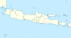
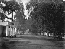
Pasuruan Kota Pasuruan | |
|---|---|
| City of Pasuruan | |
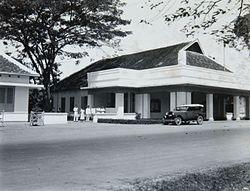 Pasuruan City Hall in 1934 | |
| Motto(s): Guna karya sarana bhakti | |
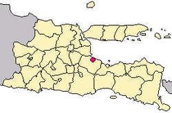 Location within East Java | |
| Coordinates: 7°38′26.24″S 112°54′23.32″E / 7.6406222°S 112.9064778°E | |
| Country | Indonesia |
| Province | East Java |
| Government | |
| • Mayor | vacant |
| • Vice Mayor | Raharto Teno Prasetyo |
| Area | |
| • Total | 35.29 km2 (13.63 sq mi) |
| Population (2014) | |
| • Total | 191,494 |
| • Density | 5,400/km2 (14,000/sq mi) |
| Time zone | UTC+7 (IWST) |
| Area code | (+62) 343 |
| Website | pasuruankota.go.id |
Pasuruan (Dutch: Pasoeroean) is a city in East Java, Java, Indonesia. It had a population of 186,262 at the 2010 Census; the latest official estimate (as of January 2014) was 191,494.
It is surrounded by, but administratively separate from, Pasuruan Regency. It is located around 65 kilometers southeast of Surabaya.
Administration
Administrative districts
Pasuruan is divided into four districts (kecamatan), tabulated below with their 2010 Census population.[1]
| Name |
|---|
| Bungulkidul |
| Gadingrejo |
| Panggungrejo |
| purworejo |
Climate
Pasuruan has a tropical savanna climate (Aw) with little to no rainfall from May to November and heavy rainfall from December to April.
| Climate data for Pasuruan | |||||||||||||
|---|---|---|---|---|---|---|---|---|---|---|---|---|---|
| Month | Jan | Feb | Mar | Apr | May | Jun | Jul | Aug | Sep | Oct | Nov | Dec | Year |
| Average high °C (°F) | 32.3 (90.1) | 32.0 (89.6) | 32.0 (89.6) | 32.0 (89.6) | 31.9 (89.4) | 31.9 (89.4) | 31.8 (89.2) | 32.4 (90.3) | 32.8 (91.0) | 33.5 (92.3) | 33.3 (91.9) | 32.6 (90.7) | 32.4 (90.3) |
| Daily mean °C (°F) | 27.4 (81.3) | 27.3 (81.1) | 27.1 (80.8) | 27.0 (80.6) | 26.5 (79.7) | 25.9 (78.6) | 25.3 (77.5) | 25.8 (78.4) | 26.4 (79.5) | 27.2 (81.0) | 27.7 (81.9) | 27.3 (81.1) | 26.7 (80.1) |
| Average low °C (°F) | 22.5 (72.5) | 22.6 (72.7) | 22.3 (72.1) | 22.0 (71.6) | 21.1 (70.0) | 19.9 (67.8) | 18.9 (66.0) | 19.3 (66.7) | 20.0 (68.0) | 21.0 (69.8) | 22.1 (71.8) | 22.1 (71.8) | 21.2 (70.1) |
| Average rainfall mm (inches) | 239 (9.4) | 259 (10.2) | 202 (8.0) | 139 (5.5) | 92 (3.6) | 61 (2.4) | 19 (0.7) | 2 (0.1) | 9 (0.4) | 20 (0.8) | 81 (3.2) | 188 (7.4) | 1,311 (51.7) |
| Source: Climate-Data.org[2] | |||||||||||||
Public transport
The Pasoeroean Stoomtram Maatschappij served from 1896 to 1988 passenger transport as well as goods transport of agricultural products such as sugarcane, tea and tobacco.
References
- ^ Situs web Kota Pasuruan - Daftar Kecamatan tahun 2013
- ^ "Climate: Pasuruan". Climate-Data.org. Retrieved 15 November 2020.
