| Panix Pass | |
|---|---|
) View from the pass towards Glarus | |
| Elevation | 2,404 m (7,887 ft)[1] |
| Traversed by | Trail |
| Location | Glarus/Graubünden, Switzerland |
| Range | Alps |
| Coordinates | 46°51′21″N 09°06′14″E / 46.85583°N 9.10389°E |
) Location in Switzerland | |
Panix Pass or Panixer Pass (Romansh: Pass dil Veptga, German: Panixerpass) (2404 m) is a Swiss Alpine pass between the cantons of Glarus and Graubünden.
The pass was once an important trade route between the canton of Glarus and Italy. It connects Elm in the Sernftal in Glarus with Pigniu (Panix) in the Vorderrhein valley of Graubünden. It is not passable by car.
In October 1799, Russian General Alexander Suvorov made a strategic retreat from the French Revolutionary forces south over the pass and regrouped his forces in Austria.
Gallery
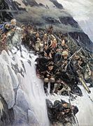
Suvorov crossing the pass in 1799
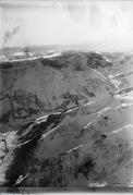
The pass in 1919
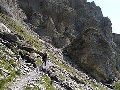
The pass in 2009
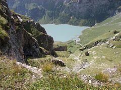
The pass in 2009
)
)
)
)
See also
References
External links
- Martin Bundi: Panix Pass in German, French and Italian in the online Historical Dictionary of Switzerland, 2006-01-18.