Ōhura | |
|---|---|
Town | |
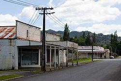
 Part of the Ōhura township | |
| Coordinates: 38°50′35″S 174°58′55″E / 38.84306°S 174.98194°E | |
| Country | New Zealand |
| Region | Manawatū-Whanganui |
| District | Ruapehu District |
| Population (2013 census) | |
| • Total | 129 |
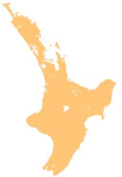
Ōhura is a small town in the west of the North Island of New Zealand. It is located to the west of Taumarunui in the area known as the King Country, in inland Manawatū-Whanganui. It lies on the banks of the Mangaroa Stream, a tributary of the Ōhura River which is a tributary of the Whanganui River.
Background
The New Zealand Ministry for Culture and Heritage gives a translation of "place which is uncovered" for Ōhura.[1] In July 2020, the name of the locality was officially gazetted as Ōhura by the New Zealand Geographic Board.[2]
Ōhura was the centre for coal mining in the region,[3] operating through to circa 1965, where previously the mines, railway network and farming had been major parts of the local industry.
According to the 2013 New Zealand census, Ōhura has a population of 129, a decrease of 36 people since the 2006 census.[4]
A proud piece of the town is the Ohura Museum which provides a repository for much of the history of Ōhura and the surrounding area.
Te Rukirangi Marae and Papakainga meeting house is located in Ōhura.[5] It is the tribal meeting ground of the Ngāti Maniapoto hapū of Te Rukirangi.[6]
Education
Ohura Valley Primary is a co-educational state primary school for Year 1 to 8 students,[7] with a roll of 6 as of March 2020.[8]
Notable people
- Frank Glasgow, All Black rugby player[9]
References
- ^ "1000 Māori place names". New Zealand Ministry for Culture and Heritage. 6 August 2019.
- ^ "Notice of approved official geographic names" (PDF). New Zealand Gazette. 16 July 2020. Retrieved 18 August 2020.
- ^ Cairns, John (2013). Coal in my blood. ISBN 9780473229290.
- ^ 2013 Census QuickStats about a place : Ohura
- ^ "Māori Maps". maorimaps.com. Te Potiki National Trust.
- ^ "Te Kāhui Māngai directory". tkm.govt.nz. Te Puni Kōkiri.
- ^ "Ministry of Education School Profile". educationcounts.govt.nz. Ministry of Education.
- ^ "Education Review Office Report". ero.govt.nz. Education Review Office.
- ^ Cooke, Ron (2013). Roll back the years No 6. Taumarunui & Districts historical Society Inc. p. 849. ISBN 978-0-9582984-5-2.
External links
- King Country places - Ōhura, Te Ara - the Encyclopedia of New Zealand
- Ohura website
