| Nova Scotia Route 209 | ||||
|---|---|---|---|---|
| Route information | ||||
| Maintained by Nova Scotia Department of Transportation and Infrastructure Renewal | ||||
| Length | 98 km[1] (61 mi) | |||
| Major junctions | ||||
| South end | ||||
| North end | ||||
| Highway system | ||||
| Provincial highways in Nova Scotia 100-series
| ||||
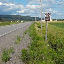
Route 209 is a collector road in the Canadian province of Nova Scotia.
It is located in Cumberland County and follows the shoreline of the Bay of Fundy, connecting Parrsboro with River Hebert. The linked communities are known as the Parrsboro Shore.
It is designated as part of the Fundy Shore Scenic Drive.[2] Highway 209 was formerly designated as Trunk Highway 9.
Communities
Parks
- Cape Chignecto Provincial Park
- Chignecto Game Sanctuary
History
The section of Collector Highway 209 from Parrsboro to Apple River was once designated as Trunk Highway 9.
See also
References
- ^ Atlantic Canada Back Road Atlas ISBN 978-1-55368-618-7 Pages 50, 65-66
- ^ Scenic Roadways Locator Map (PDF) (Map). 1:1,100,000. Province of Nova Scotia. 2019.
