| ||||
|---|---|---|---|---|
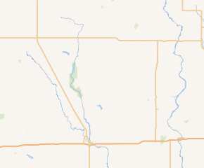 ND 9 highlighted in red | ||||
| Route information | ||||
| Maintained by NDDOT | ||||
| Length | 53.597 mi[1] (86.256 km) | |||
| Major junctions | ||||
| West end | ||||
| East end | ||||
| Location | ||||
| Counties | Foster, Stutsman, Barnes | |||
| Highway system | ||||
| ||||
.svg.png'))
North Dakota Highway 9 (ND 9) is a state highway in eastern North Dakota. It follows a zigzag pattern from U.S. Route 52 (US 52) and US 281 at Melville to ND 1 outside of Rogers. ND 9 originally extended to Canada, and at its current eastern terminus, it followed the route of what is now ND 1 south, but when US 52 was extended into North Dakota, ND 9 was truncated to its current terminus.
Route description
The route starts at an intersection with US 52/US 281 near Melville.[2] It then goes about 22 miles (35 km) without any intersections, passing the Stutsman county line along the way. ND 20 then merges into the route from 86th Avenue,[2] thus beginning the route's concurrency with ND 20. ND 20 then splits using 92nd Avenue[2] in Courtenay. After passing the Barnes county line and going approximately 25 miles (40 km), passing through the city of Wimbledon in the process, the highway ends at ND 1 near Rogers.
History
ND 9 originally extended to the Canadian border along what is now US 52. At its current eastern terminus, the route turned south and followed current ND 1, then turned east and went through Valley City. East of Valley City, the highway turned south again and followed what is now ND 32. When US 52 was extended into North Dakota around 1935, ND 9 was truncated to its current alignment.
Major intersections
| County | Location | mi[1] | km | Destinations | Notes |
|---|---|---|---|---|---|
| Foster–Stutsman county line | Melville–Walters township line | 0.000 | 0.000 | Western terminus | |
| Stutsman | Durham Township | 22.620 | 36.403 | Western end of ND 20 concurrency | |
| Courtenay | 28.003 | 45.066 | Eastern end of ND 20 concurrency | ||
| Barnes | Rogers Township | 53.597 | 86.256 | Eastern terminus | |
1.000 mi = 1.609 km; 1.000 km = 0.621 mi
| |||||
References
- ^ a b ROW/Corner Recordation Viewer (Map). Cartography by NDDOT. North Dakota Department of Transportation. Retrieved January 23, 2013.
- ^ a b c Map of ND 9 from Google https://www.google.com/maps/preview#!q=North+Dakota+Highway+9&data=!1m4!1m3!1d156081!2d-98.8051963!3d47.2830001!4m15!2m14!1m13!1s0x52daaeb7acb893bb%3A0xd4db92ddbe39f8dd!3m8!1m3!1d45576!2d-77.5900874!3d37.594506!3m2!1
External links
- The North Dakota Highways Page by Chris Geelhart
- North Dakota Signs by Mark O'Neil