| ||||
|---|---|---|---|---|
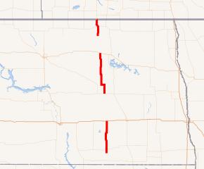 ND 30 highlighted in red | ||||
| Route information | ||||
| Maintained by NDDOT | ||||
| Length | 131.427 mi[1] (211.511 km) | |||
| Existed | before 1940–present | |||
| Southern segment | ||||
| Length | 42.426 mi (68.278 km) | |||
| South end | ||||
| North end | ||||
| Central segment | ||||
| Length | 64.800 mi (104.285 km) | |||
| South end | ||||
| North end | ||||
| Northern segment | ||||
| Length | 24.201 mi (38.948 km) | |||
| South end | ||||
| North end | ||||
| Location | ||||
| Counties | Logan, Stutsman, Wells, Benson, Pierce, Rolette | |||
| Highway system | ||||
| ||||
.svg.png'))
North Dakota Highway 30 (ND 30) is a state highway in the U.S. State of North Dakota. The highway is currently broken up into three separate segments.
Major intersections
| County | Location | mi[1] | km | Destinations | Notes | ||
|---|---|---|---|---|---|---|---|
| McIntosh | Lehr | 0.000 | 0.000 | Beginning of southern section | |||
| Logan | | 16.880 | 27.166 | Southern end of ND 34 overlap | |||
| | 17.626 | 28.366 | Northern end of ND 34 overlap | ||||
| Logan–Stutsman county line | | 25.401 | 40.879 | ||||
| Stutsman | | 42.426 | 68.278 | End of southern section | |||
| Gap in route | |||||||
| Wells | Sykeston | 88.284 | 142.079 | Beginning of central section | |||
| | 101.277 | 162.990 | Southern end of ND 15 overlap | ||||
| | 105.773 | 170.225 | Northern end of ND 15 overlap | ||||
| Benson | | 135.822 | 218.584 | ||||
| York | 153.084 | 246.365 | End of central section | ||||
| Gap in route | |||||||
| Rolette | | 181.274 | 291.732 | Beginning of northern section | |||
| Rolla | 195.080 | 313.951 | |||||
| US–Canada border | 205.475 | 330.680 | St. John Port of Entry; end of northern section | ||||
| Killarney-Turtle Mountain | | Continuation into Manitoba | |||||
1.000 mi = 1.609 km; 1.000 km = 0.621 mi
| |||||||
Notes
- ^ a b Cartography Section, Planning/Asset Management Section (2015). Route and Mileage Map (PDF) (Map). c. 1:1,900,800. Bismarck: North Dakota Department of Transportation. Retrieved July 20, 2016.
External links
- The North Dakota Highways Page by Chris Geelhart