| ||||
|---|---|---|---|---|
| Farm District Road | ||||
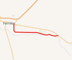 SR 828 highlighted in red | ||||
| Route information | ||||
| Maintained by NDOT | ||||
| Length | 7.736 mi[1] (12.450 km) | |||
| Major junctions | ||||
| West end | ||||
| East end | ||||
| Location | ||||
| Counties | Lyon | |||
| Highway system | ||||
| ||||
)
State Route 828 (SR 828), also known as Farm District Road, is a 7.736-mile-long (12.450 km) state highway and old alignment of U.S. Route 50 Alternate (US 50 Alt.; Lincoln Highway) between Fernley and Hazen.
_near_Fernley,_Nevada.jpg'))
View at the eastern terminus of SR 828 looking westbound
Major intersections
The entire route is in Lyon County.
| Location | mi[1] | km | Destinations | Notes | |
|---|---|---|---|---|---|
| Fernley | 0.000 | 0.000 | Roundabout; western terminus; former US 95 on US 50 Alt. east and US 95 Alt. north; former US 95 Alt. south on US 50 Alt. east | ||
| | 7.736 | 12.450 | Eastern terminus; former US 95/US 95 Alt. | ||
| 1.000 mi = 1.609 km; 1.000 km = 0.621 mi | |||||
References
- ^ a b Nevada Department of Transportation (January 2017). "State Maintained Highways of Nevada: Descriptions and Maps". Retrieved January 12, 2017.