| ||||
|---|---|---|---|---|
| Cheyenne Avenue | ||||
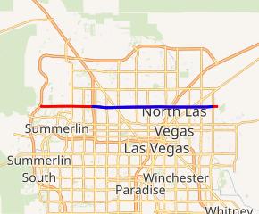 SR 574 highlighted in blue, remainder of Cheyenne Avenue in red | ||||
| Route information | ||||
| Maintained by NDOT | ||||
| Length | 10.668 mi[1] (17.168 km) | |||
| Existed | 1976–present | |||
| Major junctions | ||||
| West end | ||||
| East end | ||||
| Highway system | ||||
| ||||
)
State Route 574 (SR 574) is a major east–west section line arterial roadway in the Las Vegas Valley of Nevada. It comprises approximately 10.668 miles (17.168 km) of Cheyenne Avenue in northern Las Vegas and North Las Vegas.
Route description
_in_Las_Vegas,_Nevada.jpg'))
State Route 574 begins at U.S. Route 95 in northwest Las Vegas and heads east along Cheyenne Avenue. SR 574 then has an intersection at Rancho Drive (SR 599). At Decatur Boulevard, SR 574 enters North Las Vegas, skirting the northern edge of the North Las Vegas Airport. The highway continues east to intersect Interstate 15 and U.S. Route 93 and serves the main campus of the College of Southern Nevada. At Pecos Road, SR 574 enters the unincorporated town of Sunrise Manor where the highway has an intersection at Las Vegas Boulevard (SR 604) and continues eastward to its terminus at Nellis Boulevard (SR 612), near the southwest corner of Nellis Air Force Base.
Major intersections
The entire route is in Clark County.
| Location | mi | km | Destinations | Notes | |
|---|---|---|---|---|---|
| Las Vegas | 0.00 | 0.00 | Interchange; western terminus; US 95 exit 83 | ||
| Former US 95 | |||||
| Las Vegas–North Las Vegas line | Decatur Boulevard | ||||
| North Las Vegas | Interchange; I-15 exit 46 | ||||
| Civic Center Drive | Former SR 607 | ||||
| Sunrise Manor | Former US 91/US 93 | ||||
| Eastern terminus | |||||
| 1.000 mi = 1.609 km; 1.000 km = 0.621 mi | |||||
Public transport
RTC Transit Route 218 functions on this road.
See also
References
- ^ Nevada Department of Transportation (January 2017). "State Maintained Highways of Nevada: Descriptions and Maps". Retrieved March 11, 2017.