| Mowry Slough | |
|---|---|
IUCN category IV (habitat/species management area) | |
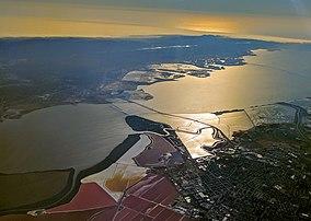
 The Mowry Slough (lower center) where it meanders between salt ponds in the south San Francisco Bay, including the Don Edwards San Francisco Bay National Wildlife Refuge and the Dumbarton Bridge, with Peninsula cities in the background | |
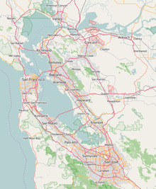
| Location | Fremont, California |
| Coordinates | 37°29′01″N 122°01′11″W / 37.4835499°N 122.0196838°W[1] |
| Designated | 1972 |
| Governing body | Don Edwards San Francisco Bay National Wildlife Refuge |
Mowry Slough[1] is a 5.8-mile-long (9.3 km)[2] slough (wetlands area) in Don Edwards San Francisco Bay National Wildlife Refuge and is the primary breeding ground for San Francisco Bay harbor seals. It is situated among the salt marshes and salt evaporation ponds in the city of Fremont.[3]
See also
- List of watercourses in the San Francisco Bay Area
- Bair Island
- Greco Island
References
- ^ a b "Mowry Slough". Geographic Names Information System. United States Geological Survey. 19 January 1981. Retrieved 5 January 2017.
- ^ U.S. Geological Survey. National Hydrography Dataset high-resolution flowline data. The National Map, accessed March 15, 2011
- ^ SFSU Archived 2007-09-07 at the Wayback Machine, Mowry Slough, retrieved August 1, 2007


