Mouriez | |
|---|---|
) The centre of the main village | |
) Coat of arms | |
Location of Mouriez 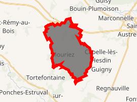 | |
) Mouriez ) Mouriez | |
| Coordinates: 50°20′25″N 1°56′46″E / 50.3403°N 1.9461°E | |
| Country | France |
| Region | Hauts-de-France |
| Department | Pas-de-Calais |
| Arrondissement | Montreuil |
| Canton | Auxi-le-Château |
| Intercommunality | CC Sept Vallées |
| Government | |
| • Mayor (2020–2026) | Christophe Dedours |
| Area 1 | 15.72 km2 (6.07 sq mi) |
| Population (Jan. 2017)[1] | 249 |
| • Density | 16/km2 (41/sq mi) |
| Time zone | UTC+01:00 (CET) |
| • Summer (DST) | UTC+02:00 (CEST) |
| INSEE/Postal code | 62596 /62140 |
| Elevation | 30–127 m (98–417 ft) (avg. 75 m or 246 ft) |
| 1 French Land Register data, which excludes lakes, ponds, glaciers > 1 km2 (0.386 sq mi or 247 acres) and river estuaries. | |
Mouriez is a commune in the Pas-de-Calais department in the Hauts-de-France region of France.
Geography
Mouriez is 12 miles (19 km) southeast of Montreuil-sur-Mer, on the D136 road.
Population
| Year | Pop. | ±% p.a. |
|---|---|---|
| 1968 | 379 | — |
| 1975 | 321 | −2.34% |
| 1982 | 313 | −0.36% |
| 1990 | 287 | −1.08% |
| 1999 | 241 | −1.92% |
| 2007 | 246 | +0.26% |
| 2012 | 247 | +0.08% |
| 2017 | 249 | +0.16% |
| Source: INSEE[2] | ||
Places of interest
- The seventeenth century church of the Nativité-de-Notre-Dame.
See also
References
- ^ "Populations légales 2017". INSEE. Retrieved 6 January 2020.
- ^ Population en historique depuis 1968, INSEE
External links
- Mouriez on the Insee website (in French)