| Mount Ellery | |
|---|---|
| Highest point | |
| Elevation | 1,280 m (4,200 ft) [1] |
| Coordinates | 37°23′36″S 148°46′41″E / 37.39333°S 148.77806°E [2] |
| Geography | |
| Location | Mount Ellery in Victoria, Australia |
| Parent range | Errinundra Plateau |
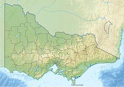
Mount Ellery, with an elevation of 1,280 metres (4,200 ft) AMSL, is a mountain that is part of the Errinundra Plateau within the Errinundra National Park, located in the East Gippsland region of the Australian state of Victoria. The mountain is approximately 11 kilometres (6.8 mi) south of the hamlet of Goongerah.
Mount Ellery is the summit end-point for the proposed Sea to Summit walk in East Gippsland. [3]
References
- ^ "Map of Mount Ellery, VIC". Bonzle Digital Atlas of Australia. Retrieved 11 January 2014.
- ^ "Mount Ellery: 15063". VICNAMES. Government of Victoria. 2 May 1966. Archived from the original on 11 January 2014. Retrieved 11 January 2014.
- ^ "Labor goes after camping vote in pledge to slash fees, build 30 new camp sites". The Age. Archived from the original on 16 November 2018. Retrieved 13 February 2019.
External links
- Engraving by Samuel Calvert
