Moissy-Cramayel | |
|---|---|
) The church in Moissy | |
) Coat of arms | |
) Location (in red) within Paris inner and outer suburbs | |
Location of Moissy-Cramayel 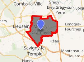 | |
) Moissy-Cramayel Location (in red) within Paris inner and outer suburbs ) Moissy-Cramayel Moissy-Cramayel (Île-de-France (region)) | |
| Coordinates: 48°37′37″N 2°35′35″E / 48.6269°N 2.5931°E | |
| Country | France |
| Region | Île-de-France |
| Department | Seine-et-Marne |
| Arrondissement | Melun |
| Canton | Combs-la-Ville |
| Intercommunality | CA Grand Paris Sud Seine-Essonne-Sénart |
| Government | |
| • Mayor (2020–2026) | Line Magne |
| Area 1 | 14.28 km2 (5.51 sq mi) |
| Population (Jan. 2017)[1] | 17,713 |
| • Density | 1,200/km2 (3,200/sq mi) |
| Time zone | UTC+01:00 (CET) |
| • Summer (DST) | UTC+02:00 (CEST) |
| INSEE/Postal code | 77296 /77550 |
| Elevation | 83–94 m (272–308 ft) |
| 1 French Land Register data, which excludes lakes, ponds, glaciers > 1 km2 (0.386 sq mi or 247 acres) and river estuaries. | |
Moissy-Cramayel (French pronunciation: [mwasi kʁamajɛl] ) is a commune in the Seine-et-Marne department in the Île-de-France region in north-central France. It is located in the metropolitan area of Paris, 33 km (21 mi) southeast from the center of Paris, in the "new town" of Sénart, created in the 1970s.
Moissy-Cramayel is one of the satellite towns of Paris, being separated from the urban area of Paris by some agricultural land. However, with the rapid growth of the area of Sénart, of which Moissy-Cramayel is a central component, it is expected that in the near future Moissy-Cramayel, like the other communes of Sénart, will become physically linked to the urban area of Paris.
Its inhabitants are called Moisséens.
History
During the French Revolution, Moissy-Cramayel was temporarily renamed Moissy-la-Plaine, meaning "Moissy the Plain".
Transportation
Moissy-Cramayel is served by Lieusaint – Moissy station on Paris RER line ![]() .
.
Miscellaneous
Moissy-Cramayel is twinned with:
- Rosenfeld, Germany - since 1971
- Rosso, Mauritania - since 1986
- Buşteni, Romania - since 1993
See also
- Communes of the Seine-et-Marne department
- Moissy Cramayel US, a football club based in Moissy-Cramayel
References
- ^ "Populations légales 2017". INSEE. Retrieved 6 January 2020.
External links
- Official website (in French)
- 1999 Land Use, from IAURIF (Institute for Urban Planning and Development of the Paris-Île-de-France région) (in English)
- Base Mérimée: Search for heritage in the commune, Ministère français de la Culture. (in French)