| ||||
|---|---|---|---|---|
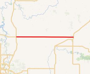 MN 247 highlighted in red | ||||
| Route information | ||||
| Defined by MS § 161.115(178) | ||||
| Maintained by MnDOT | ||||
| Length | 12.604 mi (20.284 km) | |||
| Existed | July 1, 1949[1]–present | |||
| Major junctions | ||||
| West end | ||||
| East end | ||||
| Location | ||||
| Counties | Olmsted, Wabasha | |||
| Highway system | ||||
| ||||
)
Minnesota State Highway 247 (MN 247) is a 12.604-mile-long (20.284 km) highway in southeast Minnesota, which runs from its intersection with U.S. Highway 63 in Farmington Township, north of Rochester; and continues east to its eastern terminus at its intersection with State Highway 42 in the city of Plainview.
Route description
_001.jpg'))
Highway 247 serves as an east–west route between Farmington Township, the unincorporated community of Potsdam, and the city of Plainview.
In the city of Plainview, Highway 247 follows West Broadway, which is also the main street of Plainview.
The route is legally defined as Route 247 in the Minnesota Statutes.[2]
History
Highway 247 was authorized on July 1, 1949.[1]
At the time it was marked, the highway was only paved in Potsdam and Plainview.[3] The remainder of the route was paved in the mid-1950s.[4][5]
Major intersections
| County | Location | mi[6] | km | Destinations | Notes |
|---|---|---|---|---|---|
| Olmsted | Farmington Township | 0.000 | 0.000 | ||
| 2.982 | 4.799 | ||||
| Potsdam | 3.981 | 6.407 | |||
| Wabasha | Elgin Township | 7.950 | 12.794 | CR 2 | |
| Plainview | 11.977 | 19.275 | CR 8 (10th Street NW) | ||
| 12.043 | 19.381 | CR 57 (9th Street SW) | |||
| 12.471 | 20.070 | CR 56 (3rd Street SW) | |||
| 12.681 | 20.408 | ||||
| 1.000 mi = 1.609 km; 1.000 km = 0.621 mi | |||||
References
- ^ a b "Chapter 663-H.F. No. 1792", Session Laws of Minnesota for 1949, Earl L. Berg, Commissioner of Administration, pp. 1177–1185
- ^ "161.115, Additional Trunk Highways". Minnesota Statutes. Office of the Revisor of Statutes, State of Minnesota. 2010. Retrieved December 29, 2010.
- ^ Minnesota 1950 Official Highway Map (Map). Minnesota Department of Highways. January 1, 1950. § O21-P21. Archived from the original on July 21, 2011. Retrieved December 29, 2010.
- ^ 1954 Official Road Map of Minnesota (Map). Cartography by The H.M. Gousha Company. Minnesota Department of Highways. January 1, 1954. § M18-N18. Archived from the original on August 25, 2011. Retrieved December 29, 2010.
- ^ 1956 Official Road Map of Minnesota (Map). Cartography by The H.M. Gousha Company. Minnesota Department of Highways. 1956. § M18-N18. Archived from the original on August 25, 2011. Retrieved December 29, 2010.
- ^ "Trunk Highway Log Point Listing" (PDF). Minnesota Department of Transportation. February 2, 2012. Archived from the original (PDF) on September 14, 2012. Retrieved July 9, 2012.
External links
 Media related to Minnesota State Highway 247 at Wikimedia Commons
- Highway 247 at the Unofficial Minnesota Highways Page