| ||||
|---|---|---|---|---|
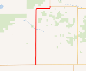 MN 219 highlighted in red | ||||
| Route information | ||||
| Defined by MS § 161.115(150) | ||||
| Maintained by MnDOT | ||||
| Length | 15.331 mi[2] (24.673 km) | |||
| Existed | July 1, 1949[1]–present | |||
| Major junctions | ||||
| South end | ||||
| North end | ||||
| Location | ||||
| Counties | Pennington, Marshall | |||
| Highway system | ||||
| ||||
)
Minnesota State Highway 219 (MN 219) is a 15.331-mile-long (24.673 km) highway in northwest Minnesota, which runs from its intersection with State Highway 1 near Goodridge and continues north to its northern terminus at its intersection with State Highway 89 near Grygla.
MN 219 passes through the communities of Goodridge Township, Goodridge, Moylan Township, and Eckvoll Township.
Route description
Highway 219 serves as a north–south connector route between State Highway 1 and State Highway 89, as well as serves the city of Goodridge. Highway 89 continues north to the city of Roseau.
Agassiz National Wildlife Refuge is located west of the junction of Highway 219 and County State-Aid Highway 7 in Marshall County. The nearby refuge surrounds Mud Lake on County State-Aid Highway 7.
The route is legally defined as Route 219 in the Minnesota Statutes.[3]
History
Highway 219 was authorized on July 1, 1949.[1]
The short section between Highway 1 and Goodridge was paved in 1950.[4][5] The remainder of the route was paved in 1954 or 1955.[6][7]
Major intersections
| County | Location | mi[2] | km | Destinations | Notes |
|---|---|---|---|---|---|
| Pennington | Goodridge Township | 0.000 | 0.000 | Southern terminus; roadway becomes CSAH 24 south | |
| 1.007 | 1.621 | ||||
| 1.992 | 3.206 | ||||
| 2.983 | 4.801 | ||||
| Marshall | Moylan Township | 5.067 | 8.155 | Southern end of CSAH 2 concurrency | |
| 7.014 | 11.288 | Northern end of CSAH 2 concurrency | |||
| Eckvoll Township | 12.097 | 19.468 | |||
| 15.401 | 24.786 | Northern terminus; roadway becomes MN 89 north | |||
| 1.000 mi = 1.609 km; 1.000 km = 0.621 mi | |||||
References
- ^ a b "Chapter 663-H.F. No. 1792", Session Laws of Minnesota for 1949, Earl L. Berg, Commissioner of Administration, pp. 1177–1185
- ^ a b "Trunk Highway Log Point Listing - Construction District 2" (PDF). Minnesota Department of Transportation. August 23, 2010. Archived from the original (PDF) on December 4, 2008. Retrieved December 11, 2010.
- ^ "161.115, Additional Trunk Highways". Minnesota Statutes. Office of the Revisor of Statutes, State of Minnesota. 2010. Retrieved December 11, 2010.
- ^ Minnesota 1950 Official State Highway Map (Map). Minnesota Highway Department. January 1, 1950. § D5. Archived from the original on July 21, 2011. Retrieved April 5, 2020.
- ^ 1951 Official Road Map of Minnesota (Map). Cartography by The H.M. Gousha Company. Minnesota Department of Highways. January 1, 1951. § D5. Archived from the original on August 25, 2011. Retrieved April 5, 2020.
- ^ 1954 Official Road Map of Minnesota (Map). Cartography by The H.M. Gousha Company. Minnesota Department of Highways. January 1, 1954. § D4-D5. Archived from the original on July 21, 2011. Retrieved April 5, 2020.
- ^ 1956 Official Road Map of Minnesota (Map). Cartography by The H.M. Gousha Company. Minnesota Department of Highways. 1956. § D4-D5. Archived from the original on 2011-07-21. Retrieved 2020-04-05.
External links