Masclat | |
|---|---|
) The chateau in Masclat | |
Location of Masclat 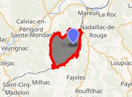 | |
) Masclat ) Masclat | |
| Coordinates: 44°50′10″N 1°23′33″E / 44.8361°N 1.3925°E | |
| Country | France |
| Region | Occitanie |
| Department | Lot |
| Arrondissement | Gourdon |
| Canton | Souillac |
| Intercommunality | Haute Bouriane |
| Government | |
| • Mayor (2001–2008) | Serge Combroux |
| Area 1 | 10.02 km2 (3.87 sq mi) |
| Population (Jan. 2017)[1] | 361 |
| • Density | 36/km2 (93/sq mi) |
| Time zone | UTC+01:00 (CET) |
| • Summer (DST) | UTC+02:00 (CEST) |
| INSEE/Postal code | 46186 /46350 |
| Elevation | 112–206 m (367–676 ft) (avg. 183 m or 600 ft) |
| 1 French Land Register data, which excludes lakes, ponds, glaciers > 1 km2 (0.386 sq mi or 247 acres) and river estuaries. | |
Masclat is a commune in the Lot department in south-western France. It has an area of 10002 ha.
See also
References
- ^ "Populations légales 2017". INSEE. Retrieved 6 January 2020.
External links
- Masclat website (in French)