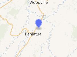
Mangatainoka | |
|---|---|
.jpg) Tui Brewery at Mangatainoka | |
 | |
| Coordinates: 40°26′S 175°52′E / 40.433°S 175.867°E | |
| Country | |
| Region | Manawatū-Whanganui |
| Territorial authority | Tararua District |
| Government | |
| • Tararua Mayor | Tracey Collins |
| • Wairarapa MP | Kieran McAnulty |
| • Ikaroa-Rāwhiti MP | Meka Whaitiri |
| Population (June 2020) | |
| • Total | 1,800[1] |
| Time zone | UTC+12 (NZST) |
| • Summer (DST) | UTC+13 (NZDT) |
| Postcode | 4973, 4971, 4970 |
Mangatainoka is a small settlement in the Tararua District of New Zealand's North Island. It is located on the banks of the Mangatainoka River, 5 km (3.1 mi) north of Pahiatua.
Mangatainoka is home to the nationally famous Tui Brewery which provides brewery tours, lunches and a garden bar open late morning until late afternoon. It also has a golf course.[2]
Geography
The greater Mangatainoka area, as defined by Statistics New Zealand, covers an area of 496.79 km².[3]
History
The estimated population of the greater Mangatainoka area reached 2,040 in 1996.[4]
It dropped to 1,800 in 2001, 1,780 in 2006, 1,600 in 2013, and 1,660 in 2018.[4]
Demography
The greater Mangatainoka area has an estimated population of 1,800, with a population density of 3.62 people per km².[5]
As of the 2018 census, the median age was 60.1, the median income was $32,700, 5.9% of people earned over $100,00, 15.0% had a Bachelor's Degree or higher, and 3.0% of the workforce was unemployed.[4]
Ethnically, the population was 92.6% New Zealand European, 14.5% Māori, 1.0% Pacific peoples and 1.7% Asian; 7.7% were born overseas.[4]
Religiously, the population is 49.9% non-religious and 38.6% Christian.[4]
Economy
In 2018, 7.2% worked in manufacturing, 6.0% worked in construction, 3.3% worked in hospitality, 3.6% worked in transport, 6.9% worked in education, and 8.1% worked in healthcare.[4]
Transportation
As of 2018, among those who commute to work, 55.9% drove a car, 2.4% rode in a car, 0.6% use a bike, and 0.6% walk or run. No one commuted by public transport.[4]
Mangatainoka railway station and railway line opened to Mangatainoka in August 1897 and the settlement was briefly the terminus of the Wairarapa Line until the final section to a junction with the Palmerston North–Gisborne Line in Woodville was opened on 11 December 1897.[6] Passenger train services were originally provided by the Napier Express until it was re-routed via the former Wellington and Manawatu Railway Company's western line through the Kapiti Coast and Horowhenua in early 1909.[7]
It was replaced by the Wairarapa Mail, which served Mangatainoka until 1948, when it was fully replaced by the NZR RM Wairarapa class railcars that had begun operating some services in 1936.[8] Standard and 88 seater class railcars also operated to Mangatainoka, especially after the Wairarapa railcars were withdrawn in the wake of the Rimutaka Incline's 1955 closure. Carriage trains through Mangatainoka were reintroduced in 1964 but did not fully replace the railcars until 1977.
As roads in the area improved through the 1980s, passenger numbers declined and all services north of Masterton ceased on 29 July 1988. Since this time, only freight trains have regularly operated through Mangatainoka; passenger services have been limited to occasional excursions, typically organised by enthusiast societies.[9]
Education
Mangatainoka School is a co-educational state primary school for Year 1–8 students,[10] with a roll of 74 as of March 2020.[11]
References
- ^ "Population estimate tables - NZ.Stat". Statistics New Zealand. Retrieved 22 October 2019.
- ^ Pahiatua Golf Club at Mangatainoka
- ^ "Statistical Area 2 2018 (generalised) GIS" (Data table). stats.govt.nz. Statistics New Zealand.
- ^ a b c d e f g "Place Summary – Mangatainoka". Stats NZ. Statistics New Zealand.
- ^ "Provisional Statistics". stats.govt.nz. Statistics New Zealand.
- ^ Churchman & Hurst 2001, p. 160.
- ^ J. D. Mahoney, Kings of the Iron Road: Steam Passenger Trains of New Zealand (Palmerston North: Dunmore Press, 1982), pg. 51.
- ^ Mahoney, Kings of the Iron Road, pp. 81–86.
- ^ Churchman & Hurst 2001, p. 161-2.
- ^ "Ministry of Education School Profile". educationcounts.govt.nz. Ministry of Education.
- ^ "Education Review Office Report". ero.govt.nz. Education Review Office.
Further reading
- Churchman, Geoffrey B; Hurst, Tony (2001) [1990, 1991]. The Railways of New Zealand: A Journey through History (Second ed.). Transpress New Zealand. ISBN 0-908876-20-3.