| Moscow Ring Road (MKAD) Московская кольцевая автомобильная дорога | |
|---|---|
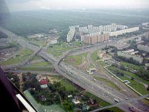
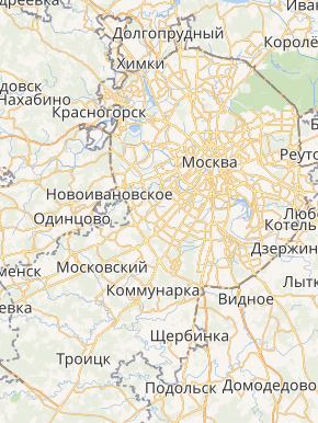 MKAD on Moscow map[1] | |
 | |
| Route information | |
| Part of | |
| Length | 108.9 km (67.7 mi) |
| Existed | 1961–present |
| Location | |
| Major cities | Moscow |
| Highway system | |
| Russian Federal Highways | |
The Moscow Automobile Ring Road (Russian: Московская кольцевая автомобильная дорога, Moskovskaya Koltsevaya Avtomobilnaya Doroga), or MKAD (МКАД), is a ring road encircling the parts of Moscow, Russia. The length of the road is 108.9 km (67.7 mi), and the number of exits is 35 (including 10 interchanges).
History
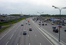
The growth of traffic in and around Moscow in the 1950s made the city planners realise Russia's largest metropolis needed a bypass to redirect incoming traffic from major roads that run through the city. Opened in 1961, the MKAD had four lanes of asphalt running 108.9 kilometres along the city borders. Although not yet a freeway, it featured interchanges at major junctions, very few traffic lights and a speed limit of 100 km/h (62 mph).
For a long time the MKAD served as the administrative boundary of Moscow city, until in the 1980s Moscow started annexing territory outside the beltway. In December 2002 Bulvar Dmitriya Donskogo became the first Moscow Metro station that opened beyond the limits of MKAD.[2]
In 1995–1999, the road was widened from the initial four to ten lanes, while all intersections became grade-separated, bridges were built to accommodate pedestrians, traffic lights were removed, and a solid concrete barrier was installed in the median. In 2001, all slow-moving vehicles were banned from entering the MKAD, and the renovated road received a freeway designation from the mayor's office.
Route
| Distance (approx.) | Destinations | Notes | |
|---|---|---|---|
| 0 km | |||
| 2 km | Pobeda ulitsa — Reutov, Ivanovskoe | ||
| 4 km | Ketcherskaya ulitsa, Nosovikhinskoye ulitsa — Balashikha, Elektrougli | ||
| 6 km | Novokosino District | ||
| 7 km | Moldagulovoy ulitsa, Novoukhtomskoe shosse | ||
| 8 km | North-Eastern Chord, Kosinskoe Highway | ||
| 8 km | Ryazansky prospekt, Lermontovsky prospekt — Lyubertsy | ||
| 11 km | |||
| 14 km | Verkhniye Polya ulitsa — Kotelniki | ||
| 16 km | Energetikov ulitsa, Kapotnya ulitsa — Dzerzhinsky, Kapotnya | ||
| 20 km | Besedinskoe shosse — Besedy | ||
| 24 km | Kashira Highway | ||
| 27 km | |||
| 30 km | Bulatnikovo | ||
| 33 km | |||
| 35 km | Polyany ulitsa — Butovo | ||
| 38 km | Paustovskogo ulitsa — Yasenevo | ||
| 41 km | |||
| 45 km | |||
| 48 km | Borovskoye shosse, Ozyornaya ulitsa | ||
| 55 km | |||
| 56 km | Gorbunova ulitsa — Nemchinovka | ||
| 60 km | |||
| 61 km | Rublevo-Uspenskoye shosse — Rublevo | ||
| 63 km | |||
| 65 km | Myankininsky prospekt — Myakinino | ||
| 68 km | |||
| 72 km | Novokurkinskoye shosse — Kurkino | ||
| 74 km | Svobody ulitsa, Molodezhnaya ulitsa — Kurkino | ||
| 75 km | |||
| 78 km | |||
| 82 km | |||
| 85 km | Altufyevskoye shosse — Veshki | ||
| 91 km | Ostashskaya ulitsa | ||
| 95 km | |||
| 103 km | Khabarovskaya ulitsa — Abramtsevo | ||
| 105 km |
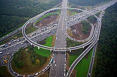
Gallery
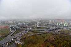
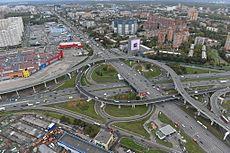
Interchange of MKAD and Kashirskoye Highway in Moscow
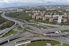
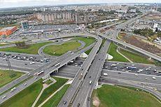
MKAD interchange with Moscow–Saint Petersburg motorway
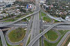
Interchange of MKAD and Leningradskoye Highway
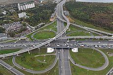
Interchange of MKAD and Borovskoe shosse
Interchange of MKAD and Mozhayskoe shosse
MKAD interchange with Novorizhskoe shosse
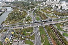
Interchange of MKAD and Volokolamskoe shosse
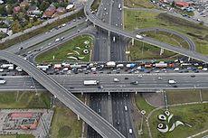
Interchange of MKAD and Yaroslavskoe shosse
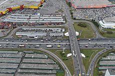
Interchange of MKAD and Myakininsky proezd
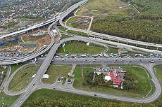
MKAD interchange with Molodogvardeyskaya street
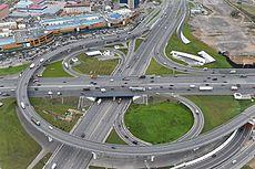
MKAD interchange with Dmitrovskoe highway
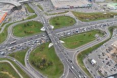
MKAD interchange with Verkhniye polya street
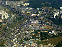
MKAD interchange with M2
MKAD near Strogino District
.jpg)
MKAD interchange with Profsoyuznaya street
Yaroslavskoe highway interchange
Interchange of MKAD and Volgogradsky Prospekt in Moscow
)
)
)
)
)
)
)
)
)
)
)
)
)
)
.jpg'))
)
)
See also
Ring roads in Moscow:
- Boulevard Ring
- Garden Ring
- Third Ring Road
- Central Ring Road
Comparison to other ring roads encircling big cities:
- Saint Petersburg Ring Road
- Ring roads of Beijing
- London Orbital motorway
- Washington, DC Beltway
- A23 in Vienna
- Boulevard Périphérique in Paris
- Grande Raccordo Anulare in Rome
- Autopista de Circunvalación M-40 and M-50 (Spain) in Madrid
- Tokyo Central Circular Expressway, Tokyo Outer Expressway and other four regular roads, encircling Tokyo
Notes and references
- ^ Map not including the new boroughs (2012) of Novomoskovsky and Troitsky
- ^ "Bul'var Dmitriya Donskogo". Moscow Metro official site. Archived from the original on 13 March 2012. Retrieved 30 June 2013.