| Scottish Gaelic name | Longa |
|---|---|
| Old Norse name | Possibly Long-øy |
| Meaning of name | Gaelic, 'long' Old Norse 'ship Island' |
| Location | |
| OS grid reference | NG736776 |
| Coordinates | 57°43′N 5°48′W / 57.72°N 5.8°W |
| Physical geography | |
| Island group | Highland |
| Area | 126 hectares (0.49 sq mi) |
| Area rank | 132 [1] |
| Highest elevation | Druim am Eilean 70 metres (230 ft) |
| Administration | |
| Sovereign state | United Kingdom |
| Country | Scotland |
| Council area | Highland Council |
| Demographics | |
| Population | 0[2] |
| References | [3][4][5] |
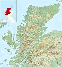
Longa Island (Gaelic: Longa) is a small uninhabited island at the mouth of Loch Gairloch, on the west coast of Scotland. Longa is nearly a mile in length with an area of 126 ha (310 acres) and a maximum height of 70 metres (230 ft) above sea level.
Geology
The island is mainly sandstone covered with grass and heather.[4]
Economy
There was a small fishing community in early in the 19th century; the island had become deserted by the latter part. Today only sheep graze the island in the summer months.
Notes and references
- ^
- ^ National Records of Scotland (15 August 2013). "Appendix 2: Population and households on Scotland's Inhabited Islands" (PDF). Statistical Bulletin: 2011 Census: First Results on Population and Household Estimates for Scotland Release 1C (Part Two) (PDF) (Report). SG/2013/126. Retrieved 14 August 2020.
- ^ Ordnance Survey: Landranger map sheet 19 Gairloch & Ullapool (Loch Maree) (Map). Ordnance Survey. 2013. ISBN 9780319231074.
- ^ a b Haswell-Smith, Hamish (2004). The Scottish Islands. Edinburgh: Canongate. ISBN 978-1-84195-454-7.
- ^ Mac an Tàilleir, Iain (2003) Ainmean-àite/Placenames. (pdf) Pàrlamaid na h-Alba. Retrieved 26 August 2012.


